MyTopo
Pearl Creek Colony South Dakota US Topo Map
Couldn't load pickup availability
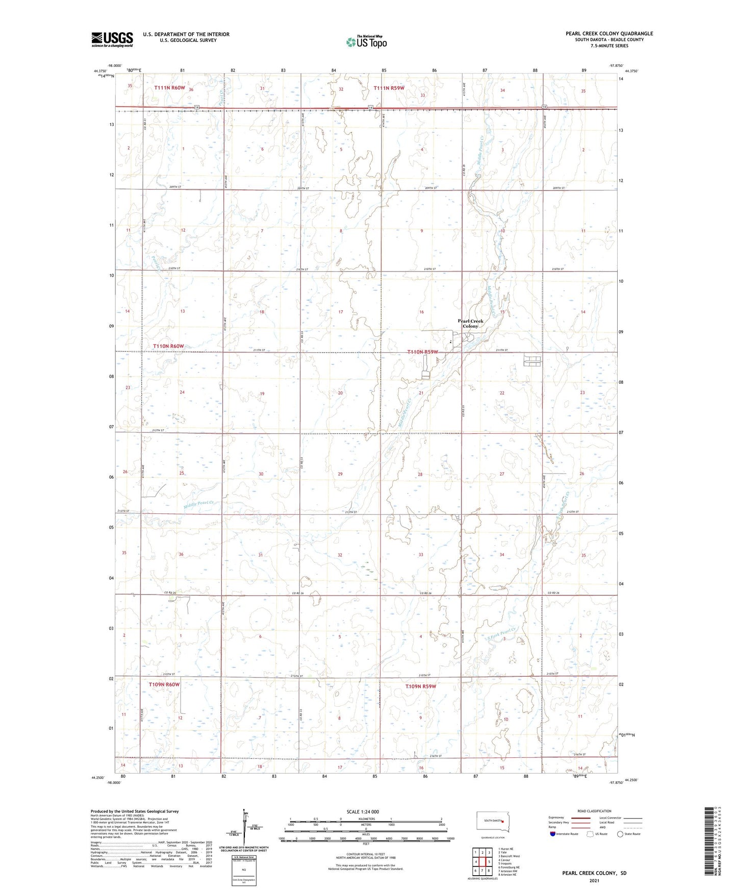
2021 topographic map quadrangle Pearl Creek Colony in the state of South Dakota. Scale: 1:24000. Based on the newly updated USGS 7.5' US Topo map series, this map is in the following counties: Beadle. The map contains contour data, water features, and other items you are used to seeing on USGS maps, but also has updated roads and other features. This is the next generation of topographic maps. Printed on high-quality waterproof paper with UV fade-resistant inks.
Quads adjacent to this one:
West: Cavour
Northwest: Huron NE
North: Yale
Northeast: Bancroft West
East: Iroquois
Southeast: Artesian NE
South: Artesian NW
Southwest: Forestburg NE
This map covers the same area as the classic USGS quad with code o44097c8.
Contains the following named places: Amsden Dam, Pearl Creek Colony, Pearl Creek Colony Census Designated Place, Pearl Creek Colony Elementary School, Township of Logan