MyTopo
Carthage South Dakota US Topo Map
Couldn't load pickup availability
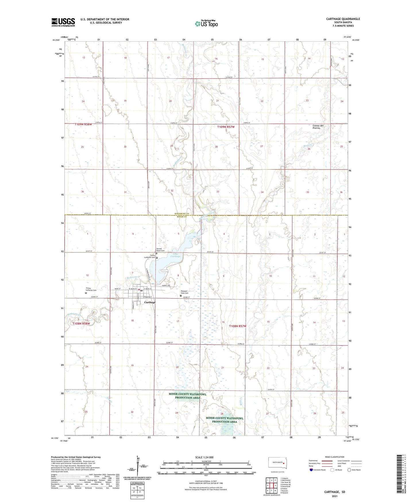
2021 topographic map quadrangle Carthage in the state of South Dakota. Scale: 1:24000. Based on the newly updated USGS 7.5' US Topo map series, this map is in the following counties: Miner, Kingsbury. The map contains contour data, water features, and other items you are used to seeing on USGS maps, but also has updated roads and other features. This is the next generation of topographic maps. Printed on high-quality waterproof paper with UV fade-resistant inks.
Quads adjacent to this one:
West: Artesian NE
Northwest: Iroquois
North: Manchester
Northeast: De Smet SE
East: Howard NE
Southeast: Howard
South: Roswell
Southwest: Fedora
This map covers the same area as the classic USGS quad with code o44097b6.
Contains the following named places: Campbell Original Straw Bale Built Museum, Carthage, Carthage Ambulance Service, Carthage Dam, Carthage Fire Department, Carthage Post Office, Carthage Public Library, Carthage Rural Fire Department, City of Carthage, Lake Carthage, Pleasant View Cemetery, Sacred Heart Cemetery, School Number 29, School Number 7, School Number 8, Township of Carthage, Township of Redstone, Trinity Lutheran Cemetery, ZIP Code: 57323