MyTopo
Joe Creek NW South Dakota US Topo Map
Couldn't load pickup availability
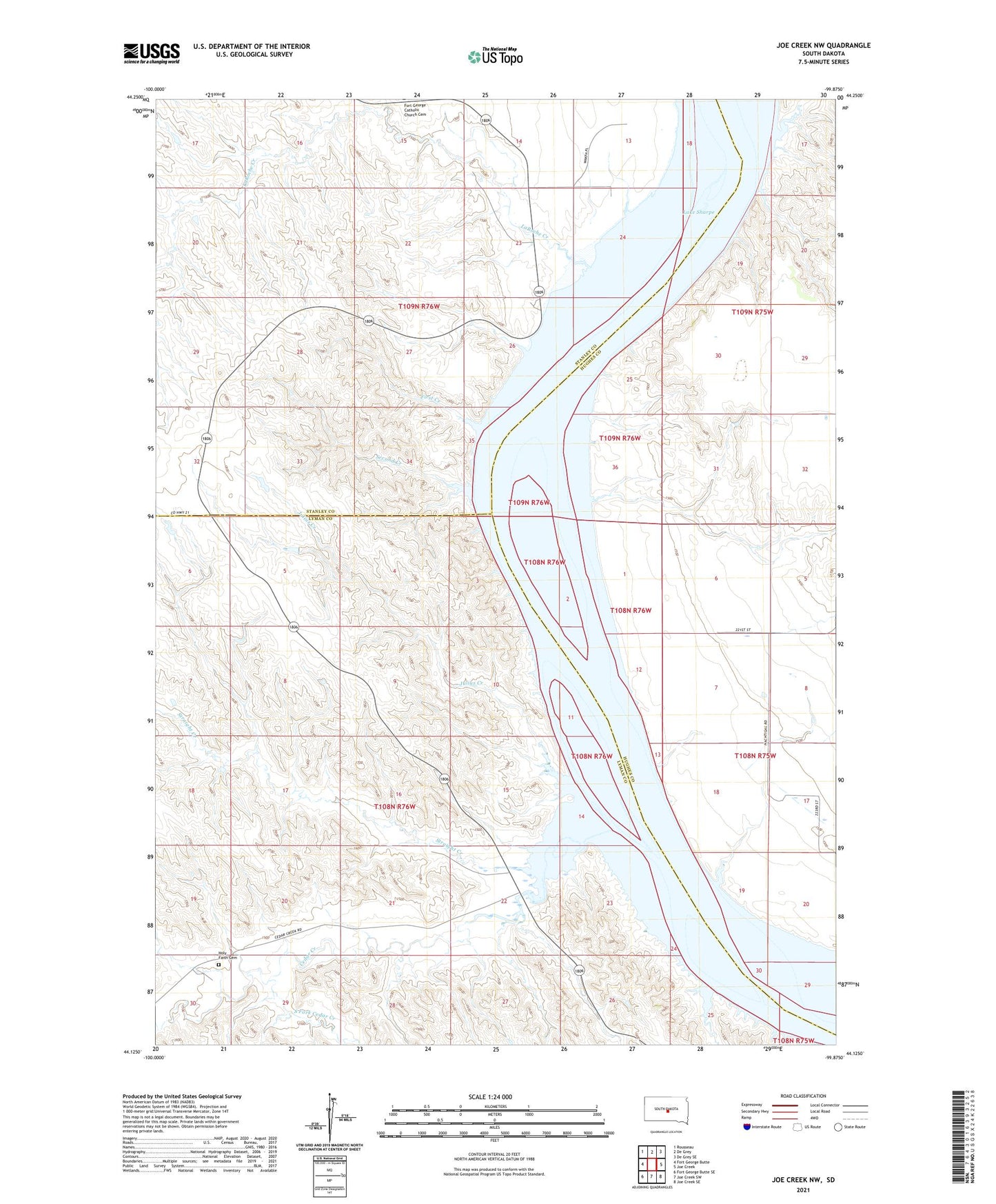
2021 topographic map quadrangle Joe Creek NW in the state of South Dakota. Scale: 1:24000. Based on the newly updated USGS 7.5' US Topo map series, this map is in the following counties: Lyman, Stanley, Hughes. The map contains contour data, water features, and other items you are used to seeing on USGS maps, but also has updated roads and other features. This is the next generation of topographic maps. Printed on high-quality waterproof paper with UV fade-resistant inks.
Quads adjacent to this one:
West: Fort George Butte
Northwest: Rousseau
North: De Grey
Northeast: De Grey SE
East: Joe Creek
Southeast: Joe Creek SE
South: Joe Creek SW
Southwest: Fort George Butte SE
Contains the following named places: Cedar Creek, Cedar Creek Island, Cedar Creek Recreation Area, Clark Ranch, Dorion Island, First Creek, Fort au Cedras, Holy Faith Cemetery, Julius Creek, Lake Sharpe, LaRoche Creek, LaRoche School, Loisels Post, Second Creek, South Fork Cedar Creek, Straight Creek, Three Sisters Islands