MyTopo
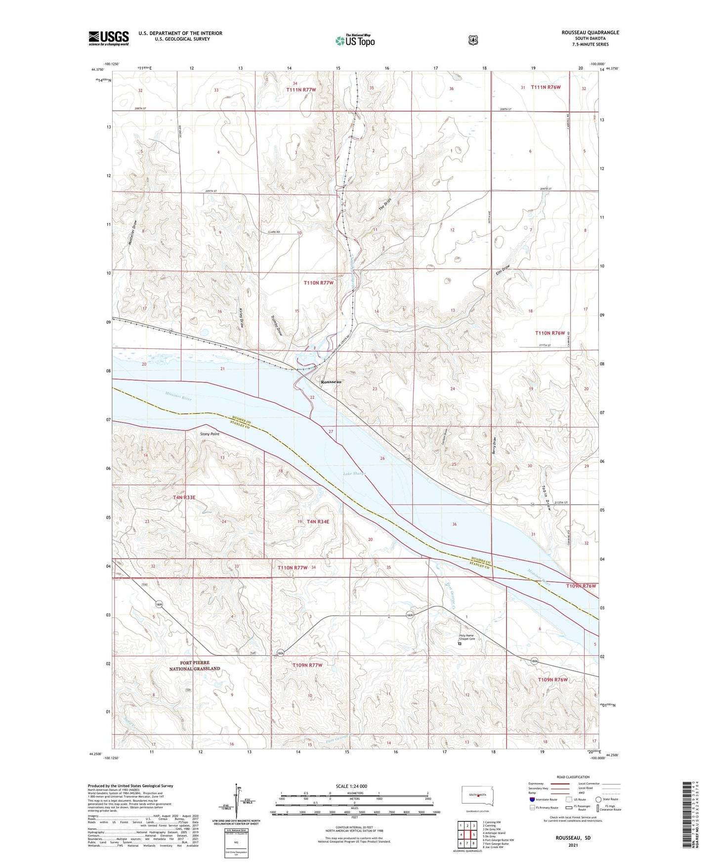
Rousseau South Dakota US Topo Map
Couldn't load pickup availability
Also explore the Rousseau Forest Service Topo of this same quad for updated USFS data
2021 topographic map quadrangle Rousseau in the state of South Dakota. Scale: 1:24000. Based on the newly updated USGS 7.5' US Topo map series, this map is in the following counties: Hughes, Stanley. The map contains contour data, water features, and other items you are used to seeing on USGS maps, but also has updated roads and other features. This is the next generation of topographic maps. Printed on high-quality waterproof paper with UV fade-resistant inks.
Quads adjacent to this one:
West: Antelope Island
Northwest: Canning NW
North: Canning
Northeast: De Grey NW
East: De Grey
Southeast: Joe Creek NW
South: Fort George Butte
Southwest: Fort George Butte NW
This map covers the same area as the classic USGS quad with code o44100c1.
Contains the following named places: Berry Draw, Carlson Draw, Elm Draw, Fort George, Fort George Creek, Fort George Island, Holy Name Chapel, Holy Name Chapel Cemetery, Kirley Draw, Medicine Knoll Creek, Mosteller Draw, Rousseau, Rousseau Recreation and Overlook Area, Rousseau School, Rousseau Station and Post Office, Stony Point, The Drips, Tobin Draw, Township of Rousseau, Trumbo Draw