MyTopo
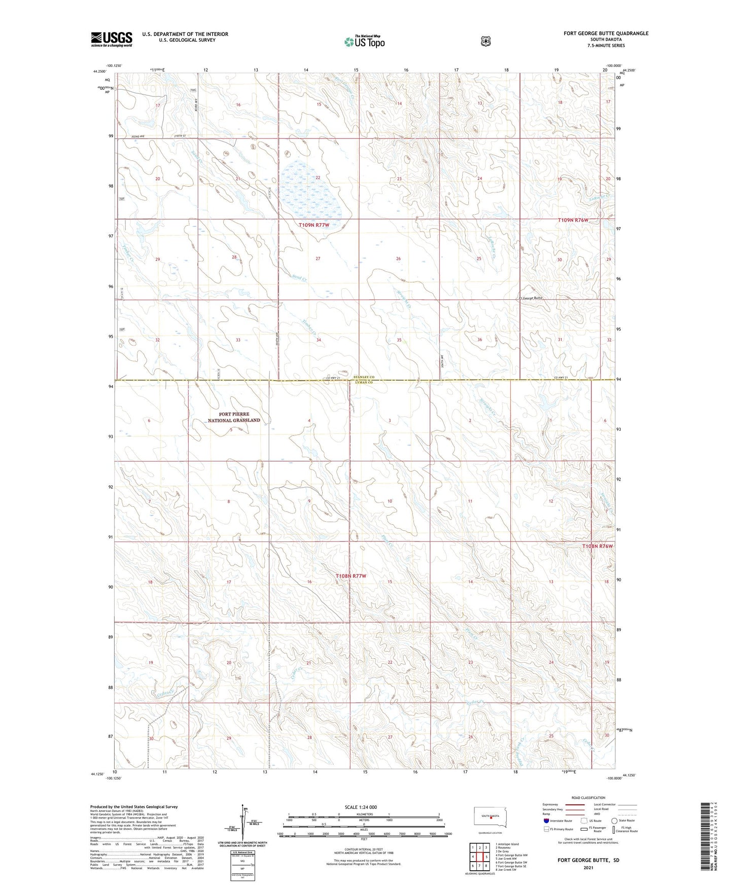
Fort George Butte South Dakota US Topo Map
Couldn't load pickup availability
Also explore the Fort George Butte Forest Service Topo of this same quad for updated USFS data
2021 topographic map quadrangle Fort George Butte in the state of South Dakota. Scale: 1:24000. Based on the newly updated USGS 7.5' US Topo map series, this map is in the following counties: Lyman, Stanley. The map contains contour data, water features, and other items you are used to seeing on USGS maps, but also has updated roads and other features. This is the next generation of topographic maps. Printed on high-quality waterproof paper with UV fade-resistant inks.
Quads adjacent to this one:
West: Fort George Butte NW
Northwest: Antelope Island
North: Rousseau
Northeast: De Grey
East: Joe Creek NW
Southeast: Joe Creek SW
South: Fort George Butte SE
Southwest: Fort George Butte SW
This map covers the same area as the classic USGS quad with code o44100b1.
Contains the following named places: Alkali Dam, Dipping Tank Creek, Fort George Butte, Plum Creek, Township of Applegate, Tribal Dam, Unorganized Territory of Lower Brule, William Smith Dam