MyTopo
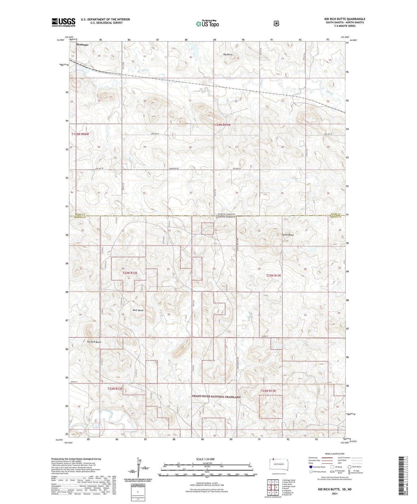
Kid Rich Butte South Dakota US Topo Map
Couldn't load pickup availability
Also explore the Kid Rich Butte Forest Service Topo of this same quad for updated USFS data
2021 topographic map quadrangle Kid Rich Butte in the states of South Dakota, North Dakota. Scale: 1:24000. Based on the newly updated USGS 7.5' US Topo map series, this map is in the following counties: Perkins, Adams. The map contains contour data, water features, and other items you are used to seeing on USGS maps, but also has updated roads and other features. This is the next generation of topographic maps. Printed on high-quality waterproof paper with UV fade-resistant inks.
Quads adjacent to this one:
Northwest: Hettinger North
North: Taylor Butte SE
Northeast: Pearl Butte
Southeast: Haynes SW
South: Lodgepole SE
Southwest: Lodgepole
This map covers the same area as the classic USGS quad with code o45102h5.
Contains the following named places: Big Butte, Castle Butte, Hettinger Country Club, Kid Rich Butte, Township of Castle Butte, Township of Scott, Unorganized Territory of Castle Butte, Wolf Butte