MyTopo
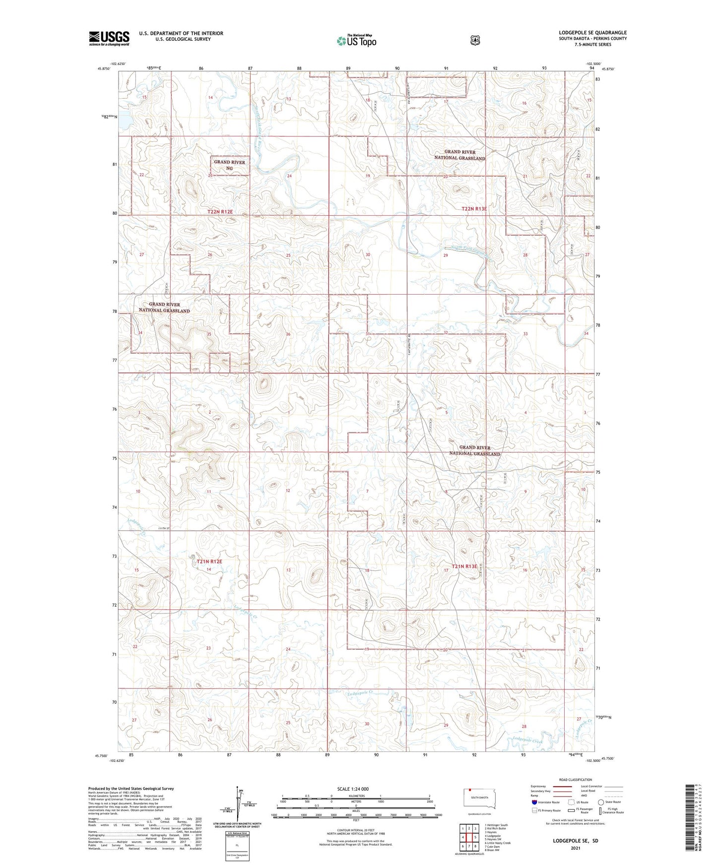
Lodgepole SE South Dakota US Topo Map
Couldn't load pickup availability
Also explore the Lodgepole SE Forest Service Topo of this same quad for updated USFS data
2021 topographic map quadrangle Lodgepole SE in the state of South Dakota. Scale: 1:24000. Based on the newly updated USGS 7.5' US Topo map series, this map is in the following counties: Perkins. The map contains contour data, water features, and other items you are used to seeing on USGS maps, but also has updated roads and other features. This is the next generation of topographic maps. Printed on high-quality waterproof paper with UV fade-resistant inks.
Quads adjacent to this one:
West: Lodgepole
North: Kid Rich Butte
East: Haynes SW
Southeast: Bison NW
South: Cole Dam
Southwest: Little Nasty Creek
This map covers the same area as the classic USGS quad with code o45102g5.
Contains the following named places: Township of Barrett, Vobedja Dam, Vobejda Lake State Game Production Area