MyTopo
Lemmon South Dakota US Topo Map
Couldn't load pickup availability
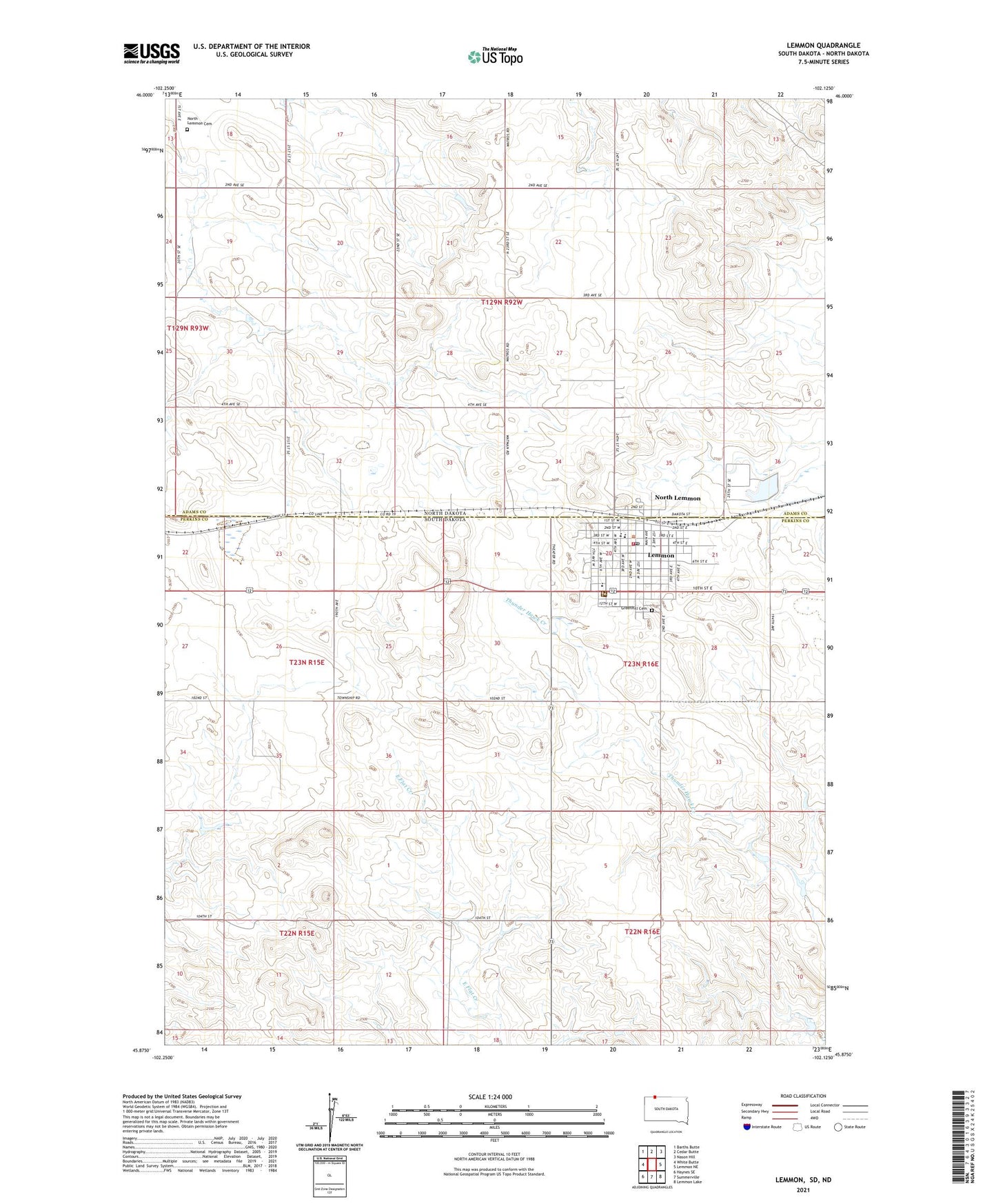
2021 topographic map quadrangle Lemmon in the states of South Dakota, North Dakota. Scale: 1:24000. Based on the newly updated USGS 7.5' US Topo map series, this map is in the following counties: Perkins, Adams. The map contains contour data, water features, and other items you are used to seeing on USGS maps, but also has updated roads and other features. This is the next generation of topographic maps. Printed on high-quality waterproof paper with UV fade-resistant inks.
Quads adjacent to this one:
West: White Butte
Northwest: Barths Butte
North: Cedar Butte
Northeast: Nason Hill
East: Lemmon NE
Southeast: Lemmon Lake
South: Summerville
Southwest: Haynes SE
This map covers the same area as the classic USGS quad with code o45102h2.
Contains the following named places: City of Lemmon, Five Counties Hospital and Nursing Home, Grand River Museum, Greenhill Cemetery, KBJM-AM (Lemmon), Lemmon, Lemmon City Hall, Lemmon Elementary School, Lemmon Emergency Medical Technician Association, Lemmon Fire Department, Lemmon High School, Lemmon Junior High School, Lemmon Police Department, Lemmon Post Office, Lemmon Public Library, North Lemmon, North Lemmon Cemetery, North Lemmon School, Township of North Lemmon