MyTopo
Lemmon NE South Dakota US Topo Map
Couldn't load pickup availability
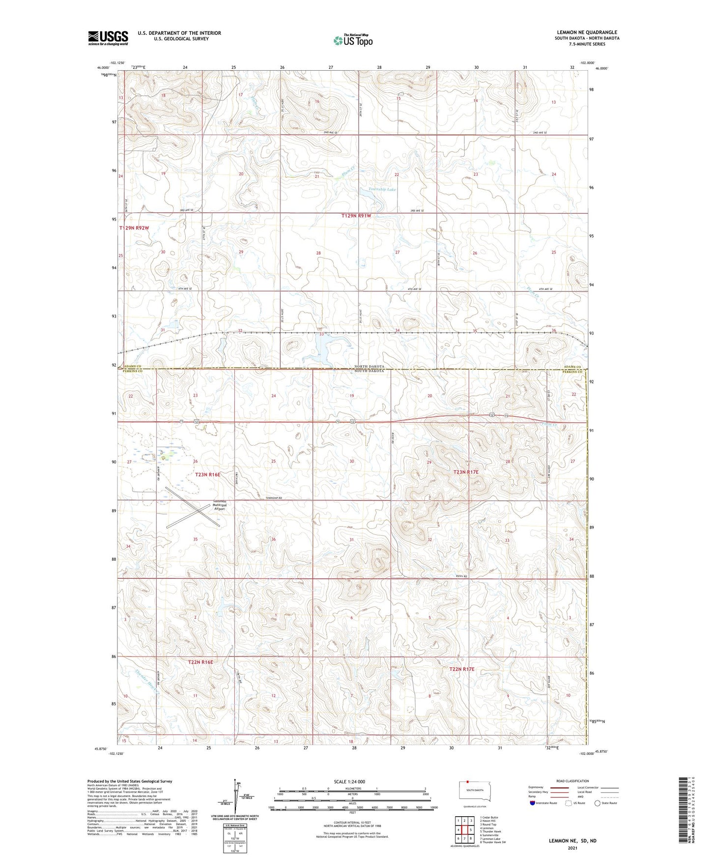
2021 topographic map quadrangle Lemmon NE in the states of South Dakota, North Dakota. Scale: 1:24000. Based on the newly updated USGS 7.5' US Topo map series, this map is in the following counties: Perkins, Adams, Corson. The map contains contour data, water features, and other items you are used to seeing on USGS maps, but also has updated roads and other features. This is the next generation of topographic maps. Printed on high-quality waterproof paper with UV fade-resistant inks.
Quads adjacent to this one:
West: Lemmon
Northwest: Cedar Butte
North: Nason Hill
Northeast: Round Top
East: Thunder Hawk
Southeast: Thunder Hawk SW
South: Lemmon Lake
Southwest: Summerville
This map covers the same area as the classic USGS quad with code o45102h1.
Contains the following named places: Allen Robinson Dam, Lemmon Municipal Airport, Meyers Lake Dam, Organge Dam, Township Lake, Township of Lincoln, Township of Orange