MyTopo
Miller South Dakota US Topo Map
Couldn't load pickup availability
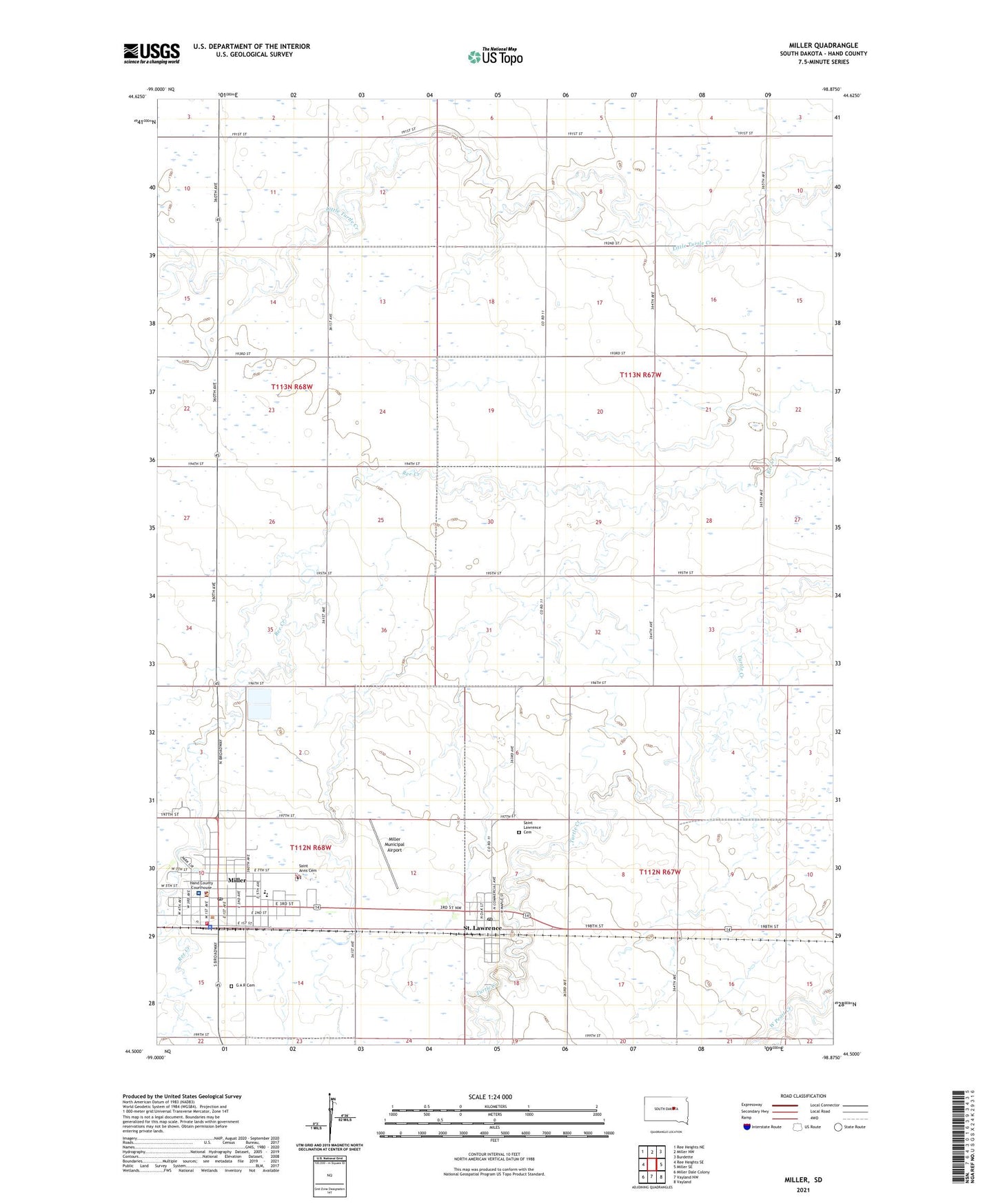
2021 topographic map quadrangle Miller in the state of South Dakota. Scale: 1:24000. Based on the newly updated USGS 7.5' US Topo map series, this map is in the following counties: Hand. The map contains contour data, water features, and other items you are used to seeing on USGS maps, but also has updated roads and other features. This is the next generation of topographic maps. Printed on high-quality waterproof paper with UV fade-resistant inks.
Quads adjacent to this one:
West: Ree Heights SE
Northwest: Ree Heights NE
North: Miller NW
Northeast: Burdette
East: Miller SE
Southeast: Vayland
South: Vayland NW
Southwest: Miller Dale Colony
This map covers the same area as the classic USGS quad with code o44098e8.
Contains the following named places: Avera Hand County Memorial Hospital and Clinic, Central Speedway, City of Miller, G A R Cemetery, Hand County Courthouse, Hand County Library, Hand County Sheriff's Office, Little Wolf Creek, Midway Drive-In, Miller, Miller City Hall, Miller Elementary School, Miller Fire Department, Miller High School, Miller Junior High School, Miller Municipal Airport, Miller Police Department, Miller Post Office, Saint Anns Cemetery, Saint Lawrence, Saint Lawrence Cemetery, Saint Lawrence Post Office, Town of Saint Lawrence, Township of Saint Lawrence, Township of York, ZIP Code: 57373