MyTopo
Mittelstedt Slough South Dakota US Topo Map
Couldn't load pickup availability
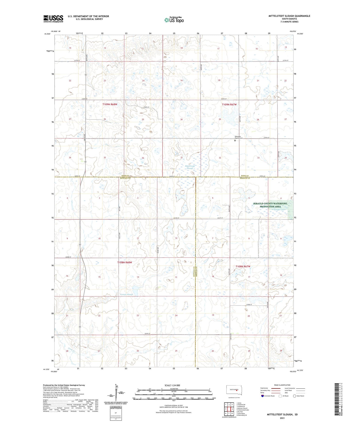
2021 topographic map quadrangle Mittelstedt Slough in the state of South Dakota. Scale: 1:24000. Based on the newly updated USGS 7.5' US Topo map series, this map is in the following counties: Hand, Buffalo, Jerauld. The map contains contour data, water features, and other items you are used to seeing on USGS maps, but also has updated roads and other features. This is the next generation of topographic maps. Printed on high-quality waterproof paper with UV fade-resistant inks.
Quads adjacent to this one:
West: Duncan Church
Northwest: Ames
North: Vayland SW
Northeast: Vayland SE
East: Cottonwood Lake
Southeast: Gannvalley SE
South: Gannvalley
Southwest: Dry Run
This map covers the same area as the classic USGS quad with code o44098b8.
Contains the following named places: Cooks Dam, Ebenezer Baptist Cemetery, Ebenezer Church, Mittelstedt Slough, Rempfer Lake, Sport Hill School Number 9, Spring Lake School, Township of Spring Lake, Voneye Slough