MyTopo
Ordway South Dakota US Topo Map
Couldn't load pickup availability
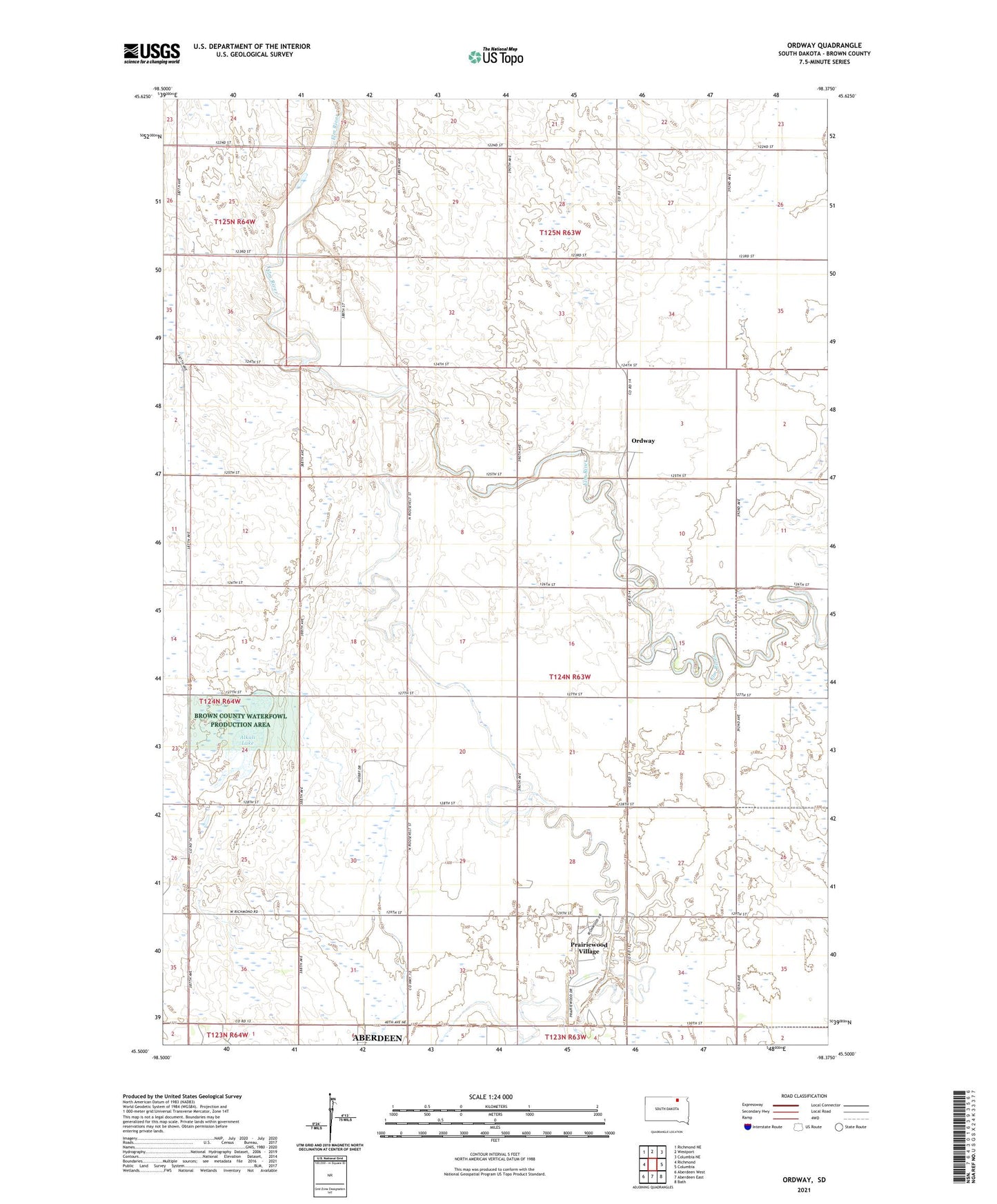
2021 topographic map quadrangle Ordway in the state of South Dakota. Scale: 1:24000. Based on the newly updated USGS 7.5' US Topo map series, this map is in the following counties: Brown. The map contains contour data, water features, and other items you are used to seeing on USGS maps, but also has updated roads and other features. This is the next generation of topographic maps. Printed on high-quality waterproof paper with UV fade-resistant inks.
Quads adjacent to this one:
West: Richmond
Northwest: Richmond NE
North: Westport
Northeast: Columbia NE
East: Columbia
Southeast: Bath
South: Aberdeen East
Southwest: Aberdeen West
This map covers the same area as the classic USGS quad with code o45098e4.
Contains the following named places: Aberdeen Filtration Plant, Alkali Lake, Deevaan Villa Development, Ordway, Prairie View School, Prairie Wood Village Addition, Prairiewood Village, Prairiewood Village Census Designated Place, Thorson School, Township of Ordway, Township of Prairiewood