MyTopo
Aberdeen West South Dakota US Topo Map
Couldn't load pickup availability
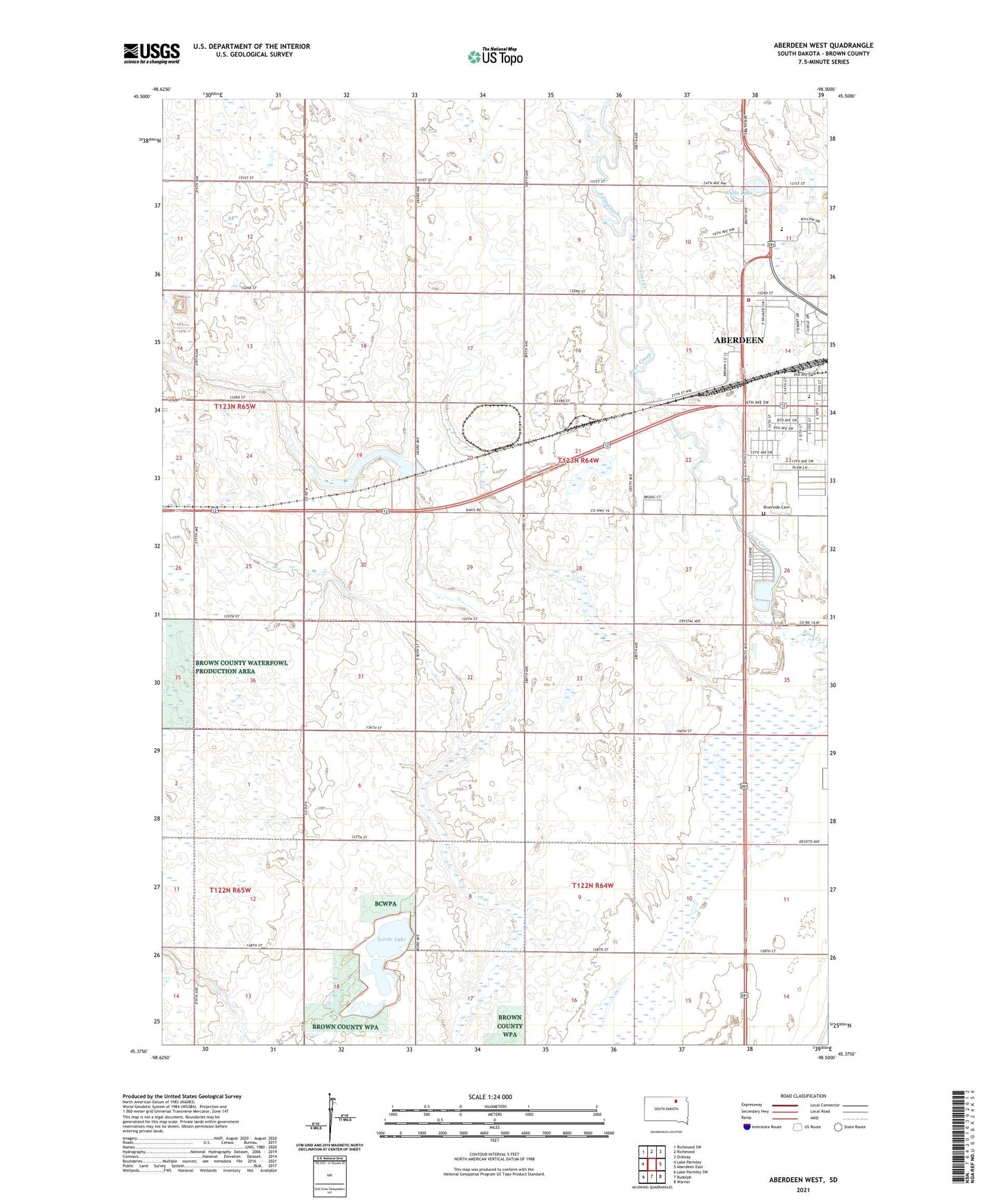
2021 topographic map quadrangle Aberdeen West in the state of South Dakota. Scale: 1:24000. Based on the newly updated USGS 7.5' US Topo map series, this map is in the following counties: Brown. The map contains contour data, water features, and other items you are used to seeing on USGS maps, but also has updated roads and other features. This is the next generation of topographic maps. Printed on high-quality waterproof paper with UV fade-resistant inks.
Quads adjacent to this one:
West: Lake Parmley
Northwest: Richmond SW
North: Richmond
Northeast: Ordway
East: Aberdeen East
Southeast: Warner
South: Rudolph
Southwest: Lake Parmley SW
This map covers the same area as the classic USGS quad with code o45098d5.
Contains the following named places: Aberdeen Country Club, Aberdeen Fire and Rescue / Advanced Care Station 2, Brookside School, Dakota Plains Surgical Center, Harlin Addition, KSDN-AM (Aberdeen), KSDN-FM (Aberdeen), Lee Park, Lincoln School, Lords Lake, Riverside Cemetery, South Dakota Highway Patrol District 1, Township of Aberdeen, Wylie Lake, Wylie Park, ZIP Code: 57401