MyTopo
Owen Lake South Dakota US Topo Map
Couldn't load pickup availability
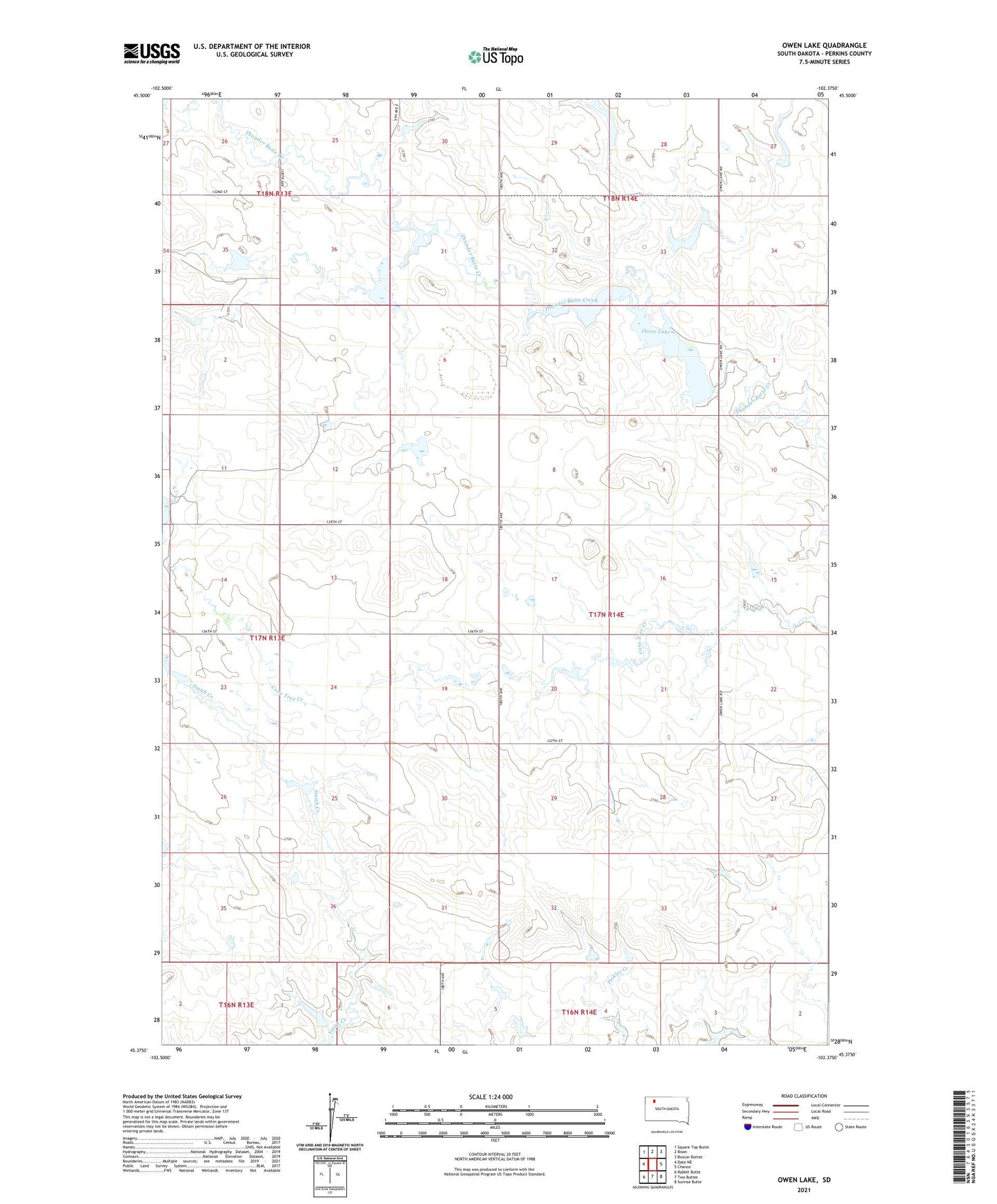
2021 topographic map quadrangle Owen Lake in the state of South Dakota. Scale: 1:24000. Based on the newly updated USGS 7.5' US Topo map series, this map is in the following counties: Perkins. The map contains contour data, water features, and other items you are used to seeing on USGS maps, but also has updated roads and other features. This is the next generation of topographic maps. Printed on high-quality waterproof paper with UV fade-resistant inks.
Quads adjacent to this one:
West: Date NE
Northwest: Square Top Butte
North: Bison
Northeast: Boxcar Buttes
East: Chance
Southeast: Sunrise Butte
South: Two Buttes
Southwest: Rabbit Butte
This map covers the same area as the classic USGS quad with code o45102d4.
Contains the following named places: Bison Dam, Gary Larson Dam, Joe Wunder Dam, John Penor Dam, Lone Tree School, Louie Englehardt Dam, Owen Lake, Perkins County, Rowbotham Dam, Rudolph Larson Dam, Township of Lone Tree