MyTopo
Platte South Dakota US Topo Map
Couldn't load pickup availability
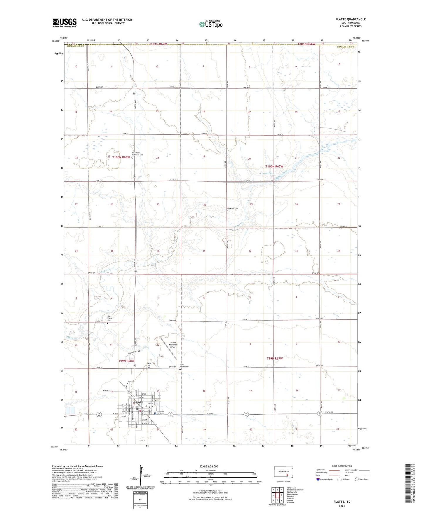
2021 topographic map quadrangle Platte in the state of South Dakota. Scale: 1:24000. Based on the newly updated USGS 7.5' US Topo map series, this map is in the following counties: Charles Mix, Brule, Aurora. The map contains contour data, water features, and other items you are used to seeing on USGS maps, but also has updated roads and other features. This is the next generation of topographic maps. Printed on high-quality waterproof paper with UV fade-resistant inks.
Quads adjacent to this one:
West: Lake George
Northwest: Snow Lake
North: Cedar Grove Colony
Northeast: Laffey Lake
East: Joubert
Southeast: Geddes
South: Bovee
Southwest: Castalia
This map covers the same area as the classic USGS quad with code o43098d7.
Contains the following named places: Calvary Baptist Church, Carrol Lake Dam, Carroll Lake, Carroll School, City of Platte, Darlington, Darlington Township Hall, Forbes School, Fridhem, Fridhem Swedish Lutheran Church, Friedhem Lutheran Cemetery, Old Platte Cemetery, Platte, Platte Ambulance Service, Platte City Cemetery, Platte City Hall, Platte Health Center Hospital, Platte Municipal Airport, Platte Police Department, Platte Post Office, Platte Public Library, Platte Volunteer Fire Department, Platte-Geddes Elementary School, Platte-Geddes High School, Platte-Geddes Junior High School, Rock Hill Cemetery, Saint Peters Cemetery, Sly Number 1 Dam, Township of Carroll, Township of Darlington, Unorganized Territory of Carroll