MyTopo
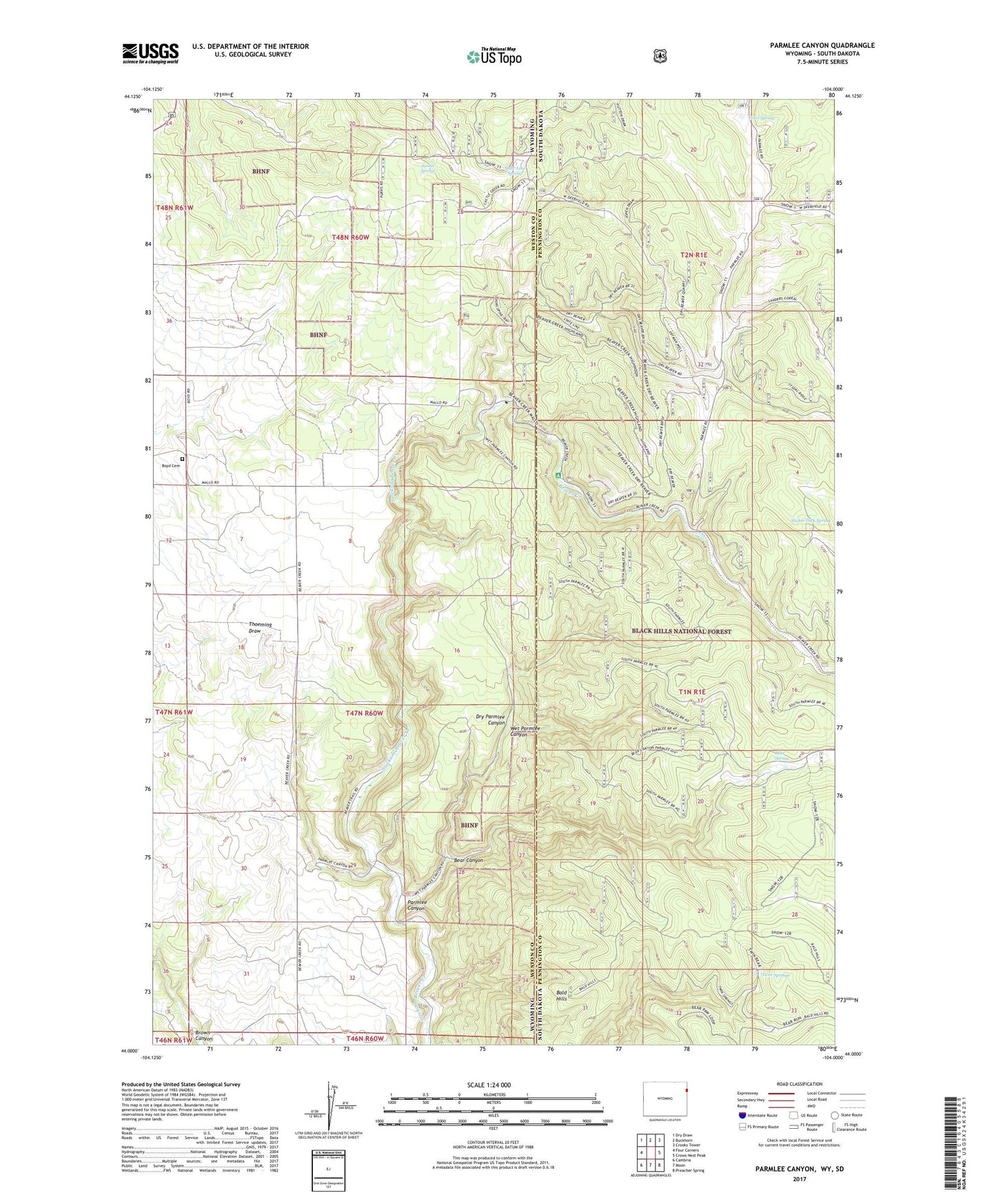
Parmlee Canyon Wyoming US Topo Map
Couldn't load pickup availability
Also explore the Parmlee Canyon Forest Service Topo of this same quad for updated USFS data
2021 topographic map quadrangle Parmlee Canyon in the states of Wyoming, South Dakota. Scale: 1:24000. Based on the newly updated USGS 7.5' US Topo map series, this map is in the following counties: Weston, Pennington. The map contains contour data, water features, and other items you are used to seeing on USGS maps, but also has updated roads and other features. This is the next generation of topographic maps. Printed on high-quality waterproof paper with UV fade-resistant inks.
Quads adjacent to this one:
West: Four Corners
Northwest: Dry Draw
North: Buckhorn
Northeast: Crooks Tower
East: Crows Nest Peak
Southeast: Preacher Spring
South: Moon
Southwest: Cambria
This map covers the same area as the classic USGS quad with code o44104a1.
Contains the following named places: Austin Spring, Bald Hills, Bear Canyon, Bear Spring, Beaver Creek, Beaver Creek Campground, Boyd Cemetery, Dry Beaver Creek, Dry Parmlee Canyon, Freel Spring, Mallo Camp, Morrison Pit Mine, Parmlee Canyon, Sanders Corral, Slicker Dick Spring, State Line Spring, Twin Springs, Wet Parmlee Canyon