MyTopo
Pringle South Dakota US Topo Map
Couldn't load pickup availability
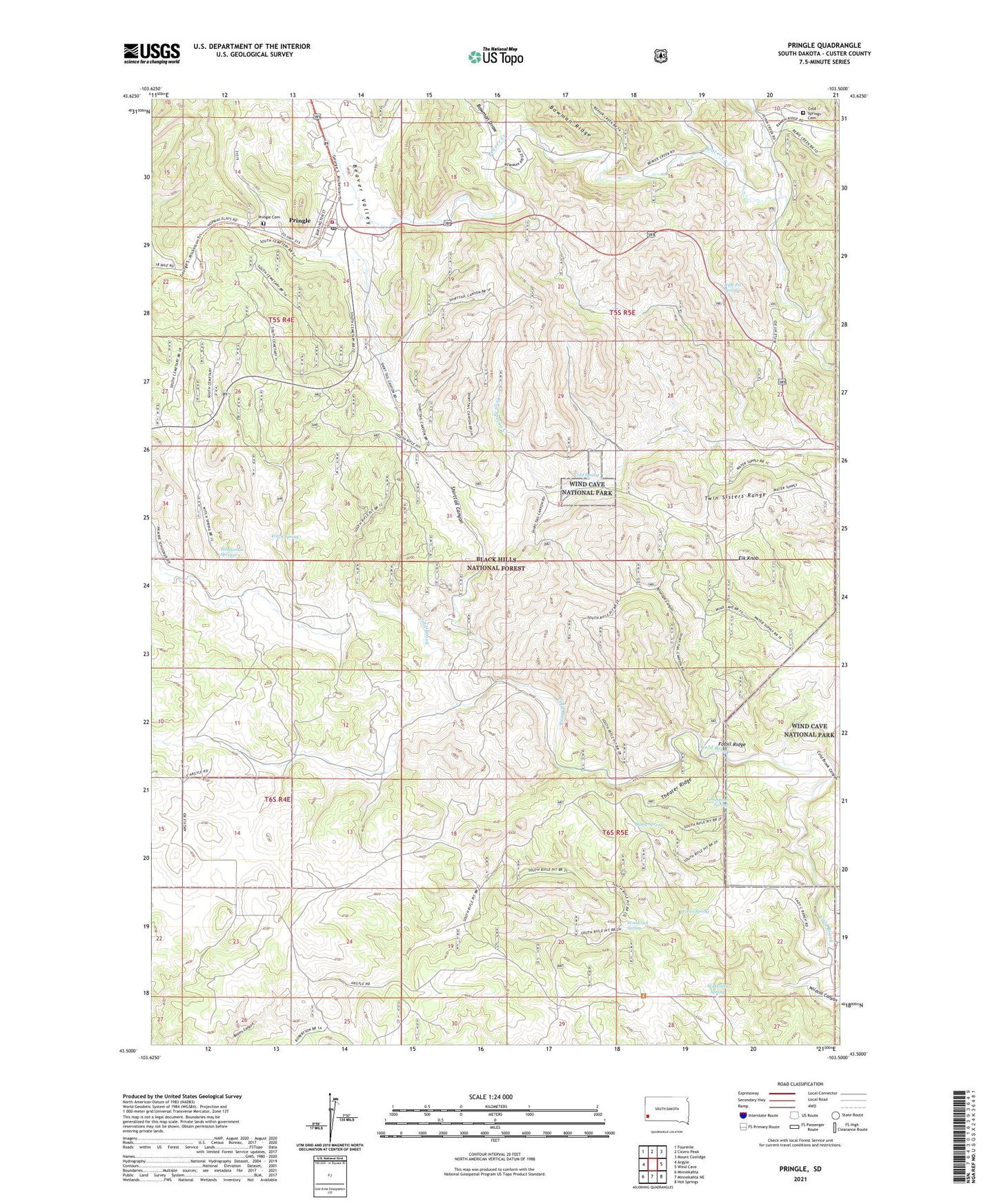
2021 topographic map quadrangle Pringle in the state of South Dakota. Scale: 1:24000. Based on the newly updated USGS 7.5' US Topo map series, this map is in the following counties: Custer. The map contains contour data, water features, and other items you are used to seeing on USGS maps, but also has updated roads and other features. This is the next generation of topographic maps. Printed on high-quality waterproof paper with UV fade-resistant inks.
Quads adjacent to this one:
West: Argyle
Northwest: Fourmile
North: Cicero Peak
Northeast: Mount Coolidge
East: Wind Cave
Southeast: Hot Springs
South: Minnekahta NE
Southwest: Minnekahta
Contains the following named places: Antelope Canyon, Beaver Valley, Booker Ranch, Bowman Draw, Bowman Ranch, Busey Spring, Capstick Ranch, Cold Spring, Cold Spring II, Cold Spring School, Cold Springs Cemetery, Corey Ranch, Elk Knob, Flutter Ranch, Fossil Ridge, Gears Ranch, Gillis Ranch, Henderson Spring, Limestone Spring, Lucky Strike Mine, McAdam Ranch, Myrtle Ann Mine, Page School, Pools Ranch, Pringle, Pringle Cemetery, Pringle Post Office, Pringle Volunteer Fire Department, Reede Mine, Retzloff Ranch, Rifle Pit Campground, Rifle Pit Spring, Sagers Ranch, Shephard Ranch, Shirttail Canyon, Smith Ranch, Tanner Ranch, Taylor Ranch, Theater Ridge, Town of Pringle, Townsite Mine, Twin Sisters Range, Wakefield Spring, Weeks Spring, Wettergren Ranch, White Ranch, Witch Spring, Woodcock Spring, Ziemet Ranch, ZIP Code: 57773