MyTopo
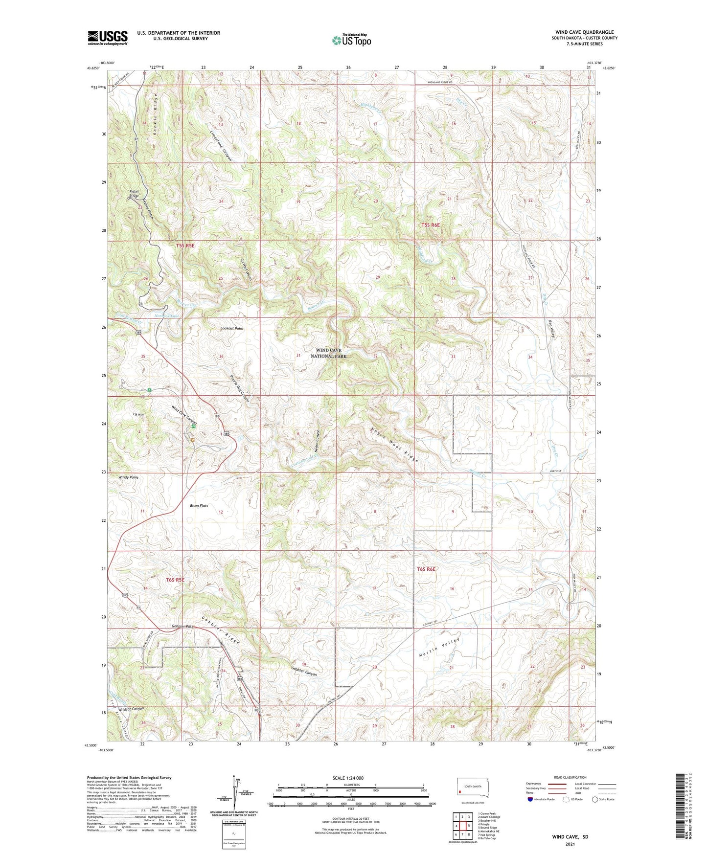
Wind Cave South Dakota US Topo Map
Couldn't load pickup availability
Also explore the Wind Cave Forest Service Topo of this same quad for updated USFS data
2021 topographic map quadrangle Wind Cave in the state of South Dakota. Scale: 1:24000. Based on the newly updated USGS 7.5' US Topo map series, this map is in the following counties: Custer. The map contains contour data, water features, and other items you are used to seeing on USGS maps, but also has updated roads and other features. This is the next generation of topographic maps. Printed on high-quality waterproof paper with UV fade-resistant inks.
Quads adjacent to this one:
West: Pringle
Northwest: Cicero Peak
North: Mount Coolidge
Northeast: Butcher Hill
East: Boland Ridge
Southeast: Buffalo Gap
South: Hot Springs
Southwest: Minnekahta NE
This map covers the same area as the classic USGS quad with code o43103e4.
Contains the following named places: Bison Flats, Cold Spring Creek, Cottonwood Creek, Curley Canyon, Dry Creek, Elk Mountain, Elk Mountain Campgrounds, Gobbler Canyon, Gobbler Pass, Gobbler Ridge, Highland Creek, Limestone Canyon, Lookout Point, Martin Valley, Martin Valley School, Negro Canyon, Negro Wool Ridge, Nobeck Dam, Norbeck Lake, Pigtail Bridge, Prairie Dog Canyon, Reaves Gulch, Red Valley, Sanson Ranch, Seven-11 Ranch, Streeter Ranch, Wildcat Canyon, Wind Cave Canyon, Wind Cave National Park, Windy Point, Zuber Ranch