MyTopo
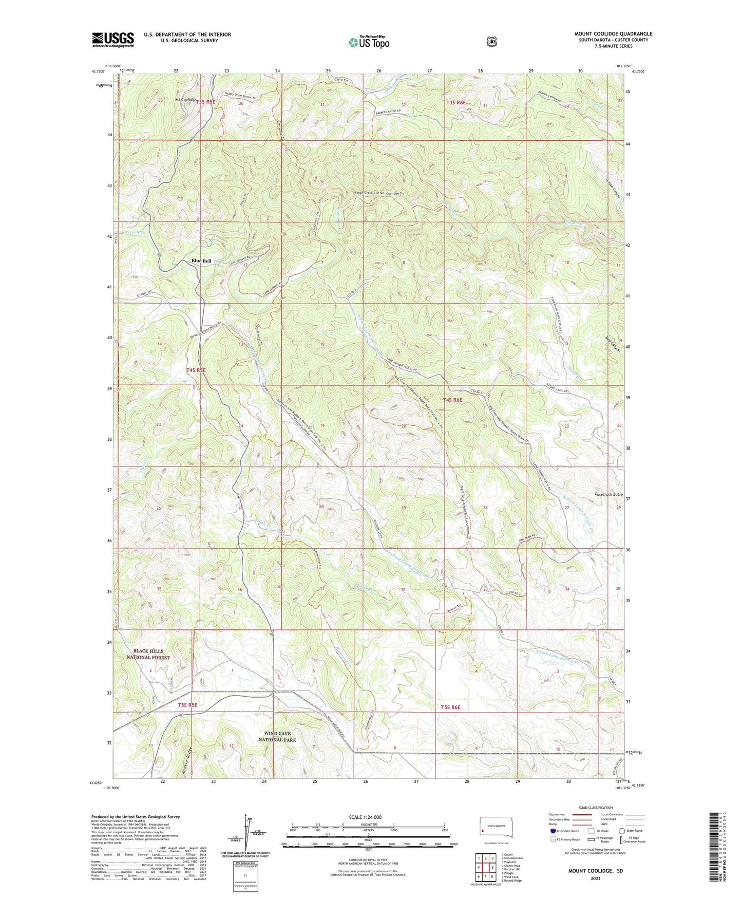
Mount Coolidge South Dakota US Topo Map
Couldn't load pickup availability
Also explore the Mount Coolidge Forest Service Topo of this same quad for updated USFS data
2021 topographic map quadrangle Mount Coolidge in the state of South Dakota. Scale: 1:24000. Based on the newly updated USGS 7.5' US Topo map series, this map is in the following counties: Custer. The map contains contour data, water features, and other items you are used to seeing on USGS maps, but also has updated roads and other features. This is the next generation of topographic maps. Printed on high-quality waterproof paper with UV fade-resistant inks.
Quads adjacent to this one:
West: Cicero Peak
Northwest: Custer
North: Iron Mountain
Northeast: Hayward
East: Butcher Hill
Southeast: Boland Ridge
South: Wind Cave
Southwest: Pringle
This map covers the same area as the classic USGS quad with code o43103f4.
Contains the following named places: Bakerville, Blue Bell, Blue Bell Campground, Camp Success, Centennial Trail, Custer County, Custer State Park, Fleur de Lis, Flynn Creek, Galena Creek, Horse Campground, Ivanhoe, Mount Coolidge, Rankin Ridge, Robbers Roost, West French Creek Primitive Campground