MyTopo
Rapid City NW South Dakota US Topo Map
Couldn't load pickup availability
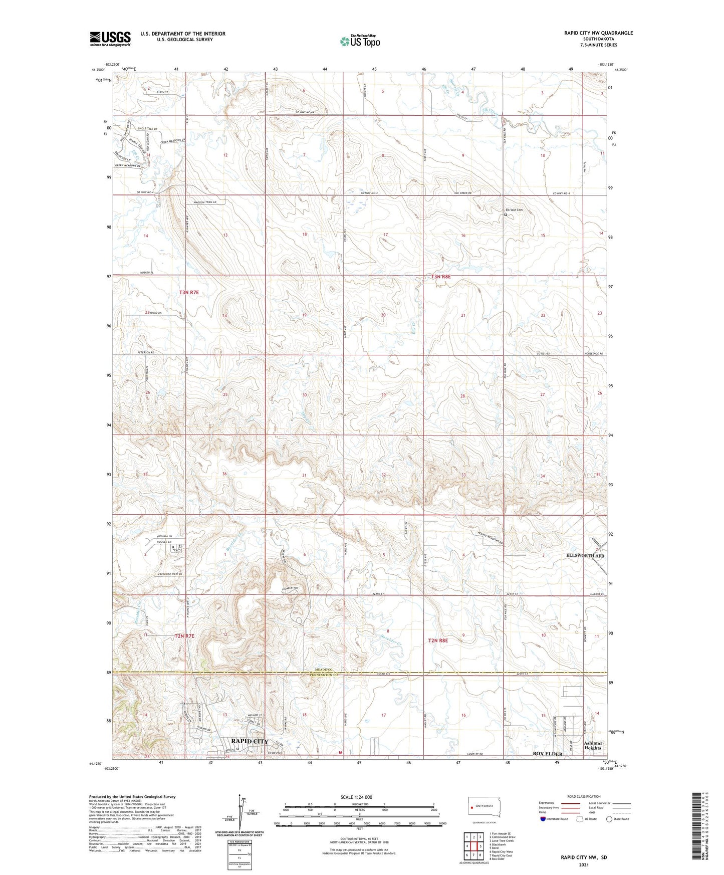
2021 topographic map quadrangle Rapid City NW in the state of South Dakota. Scale: 1:24000. Based on the newly updated USGS 7.5' US Topo map series, this map is in the following counties: Meade, Pennington. The map contains contour data, water features, and other items you are used to seeing on USGS maps, but also has updated roads and other features. This is the next generation of topographic maps. Printed on high-quality waterproof paper with UV fade-resistant inks.
Quads adjacent to this one:
West: Blackhawk
Northwest: Fort Meade SE
North: Cottonwood Draw
Northeast: Lone Tree Creek
East: Bend
Southeast: Box Elder
South: Rapid City East
Southwest: Rapid City West
Contains the following named places: Ashland Heights, Ashland Heights Census Designated Place, Elk Creek, Elk Creek Community Hall, Elk Vale Cemetery, Harmony School, Holy Family Church, Morris Creek, North Haines Volunteer Fire Department, School Number 3, ZIP Code: 57701