MyTopo
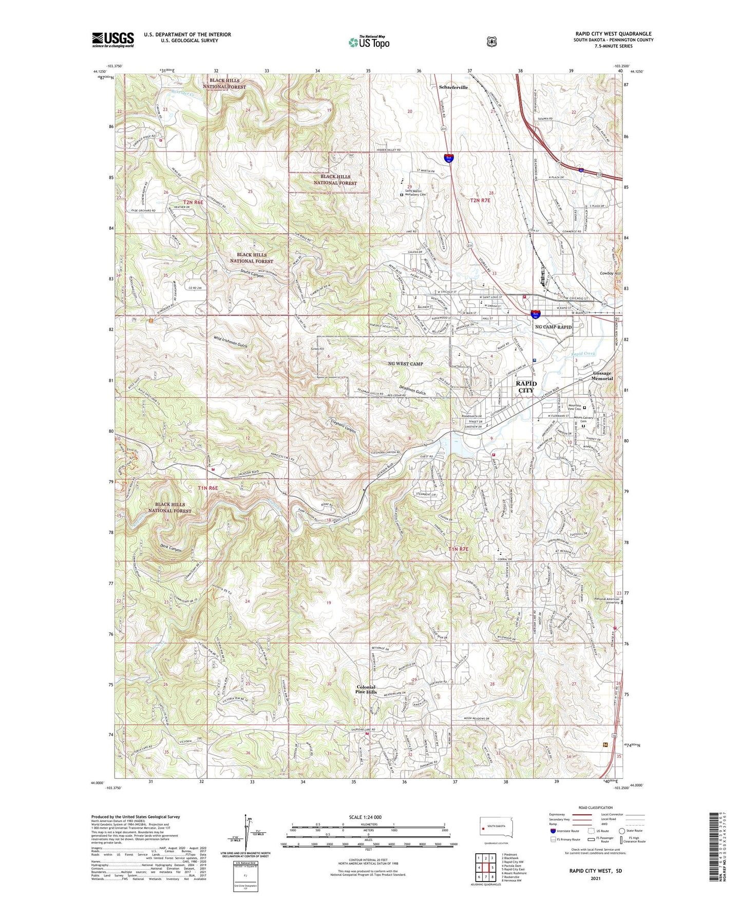
Rapid City West South Dakota US Topo Map
Couldn't load pickup availability
Also explore the Rapid City West Forest Service Topo of this same quad for updated USFS data
2021 topographic map quadrangle Rapid City West in the state of South Dakota. Scale: 1:24000. Based on the newly updated USGS 7.5' US Topo map series, this map is in the following counties: Pennington. The map contains contour data, water features, and other items you are used to seeing on USGS maps, but also has updated roads and other features. This is the next generation of topographic maps. Printed on high-quality waterproof paper with UV fade-resistant inks.
Quads adjacent to this one:
West: Pactola Dam
Northwest: Piedmont
North: Blackhawk
Northeast: Rapid City NW
East: Rapid City East
Southeast: Hermosa NW
South: Rockerville
Southwest: Mount Rushmore
This map covers the same area as the classic USGS quad with code o44103a3.
Contains the following named places: Arrowhead Country Club, Arrowhead Estates, Baken Park Shopping Center, Bennett Clarkson Hospital, Camp One, Camp Rapid, Canyon Lake, Canyon Lake Dam, Canyon Lake Elementary School, Canyon Lake Park, Captain Jacks Dry Diggins, Clarkson Addition, Cleghorn Canyon, Cleghorn School, Cleghorn Springs Fish Hatchery, Colonial Pine Hills, Colonial Pine Hills Census Designated Place, Corral Drive Elementary School, Dark Canyon, Deadman Gulch, Doty School, Doty Volunteer Fire Department Station 1, Floyd Fitzgerald Stadium, Gossage Memorial, Hall Park, Johnson Siding Volunteer Fire Department Station 2, KGGG-FM (Rapid City), Kibben-Kuster School, KTEQ-FM (Rapid City), Lake Park Campground, Lien Airfield, Meadowbrook Elementary School, Meadowbrook Golf Course, Mount Calvary Cemetery, Mountain View Cemetery, Pinedale Elementary School, Rapid City Fire Department - Station 3, Rapid City Fire Department - Station 5, Rapid City Fire Department - Station 6, Red Dale Gulch Dam, Red Dale Gulch Reservoir, Regional Behavioral Health Center, Ridgeland Heights, Saint Martin Monastery Cemetery, Schaeferville, Sioux Park, Sioux San Hospital, Sioux Sanitorium, South Canyon, South Canyon Country Estates, South Canyon Elementary School, Southwest Middle School, Stavekirke Chapel, Stevens High School, Storybook Island, Turkey Hill, Upper Rapid School, Victoria Creek, West High School, West Middle School, Whispering Pine School, Whispering Pines Volunteer Fire Department, Wild Irishman Gulch, Wildwood Addition, Winther School