MyTopo
Scott Creek South Dakota US Topo Map
Couldn't load pickup availability
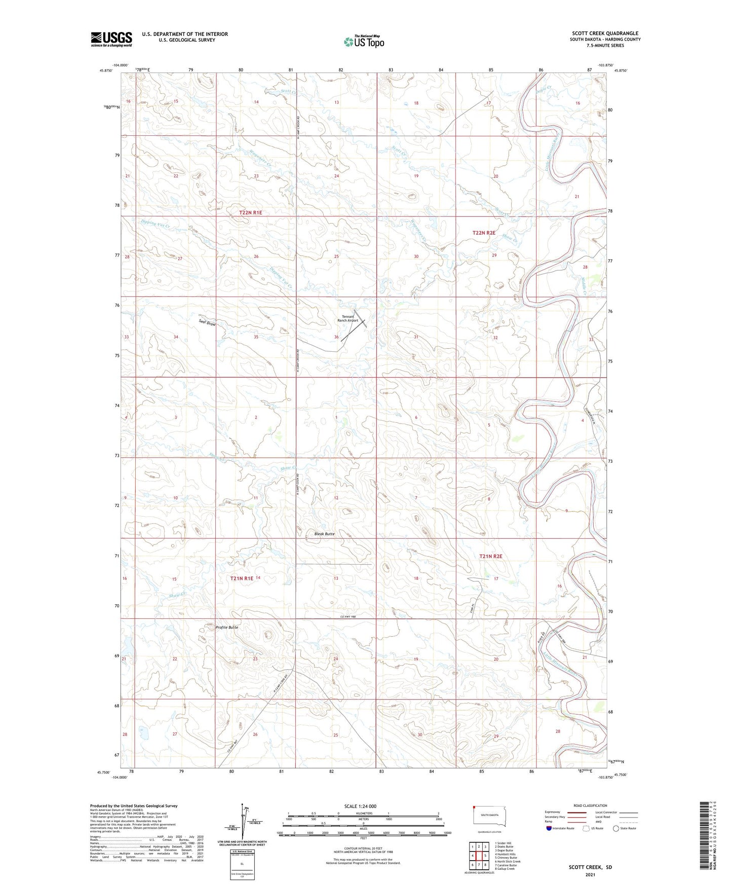
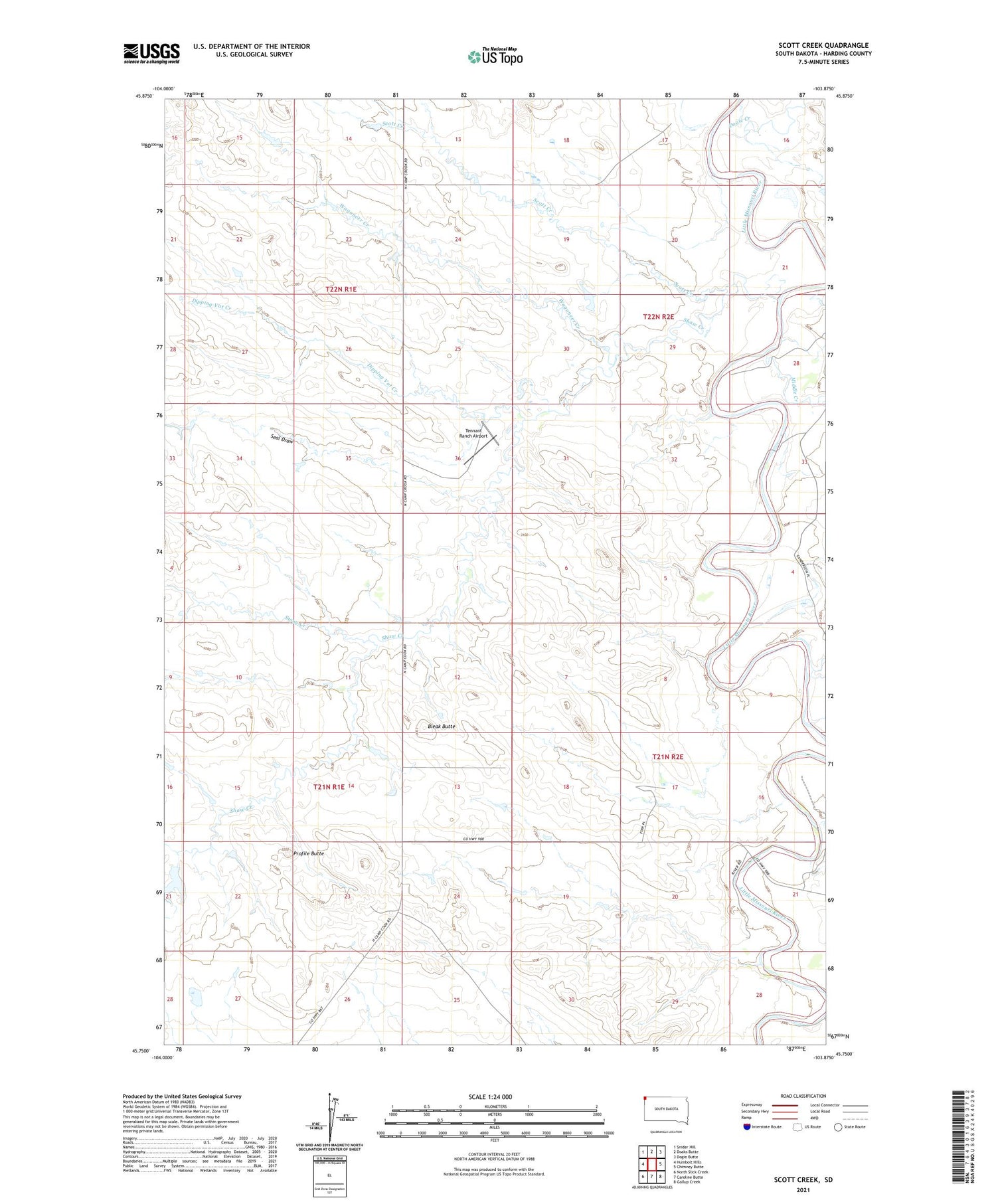
2021 topographic map quadrangle Scott Creek in the state of South Dakota. Scale: 1:24000. Based on the newly updated USGS 7.5' US Topo map series, this map is in the following counties: Harding. The map contains contour data, water features, and other items you are used to seeing on USGS maps, but also has updated roads and other features. This is the next generation of topographic maps. Printed on high-quality waterproof paper with UV fade-resistant inks.
Quads adjacent to this one:
West: Humbolt Hills
Northwest: Snider Hill
Northeast: Dogie Butte
East: Chimney Butte
Southeast: Gallup Creek
South: Caroline Butte
Southwest: North Slick Creek
Contains the following named places: Bleak Butte, Dipping Vat Creek, Dogie Creek, Dry House Creek, Kimble Creek, Middle Creek, Mud Butte Dam, Profile Butte, Salmen Ford, Scott Creek, Seal Draw, Shaw Creek, Stony Creek, Tennant Ranch Airport, Wagoneer Creek, Watson, Willett