MyTopo
Caroline Butte South Dakota US Topo Map
Couldn't load pickup availability
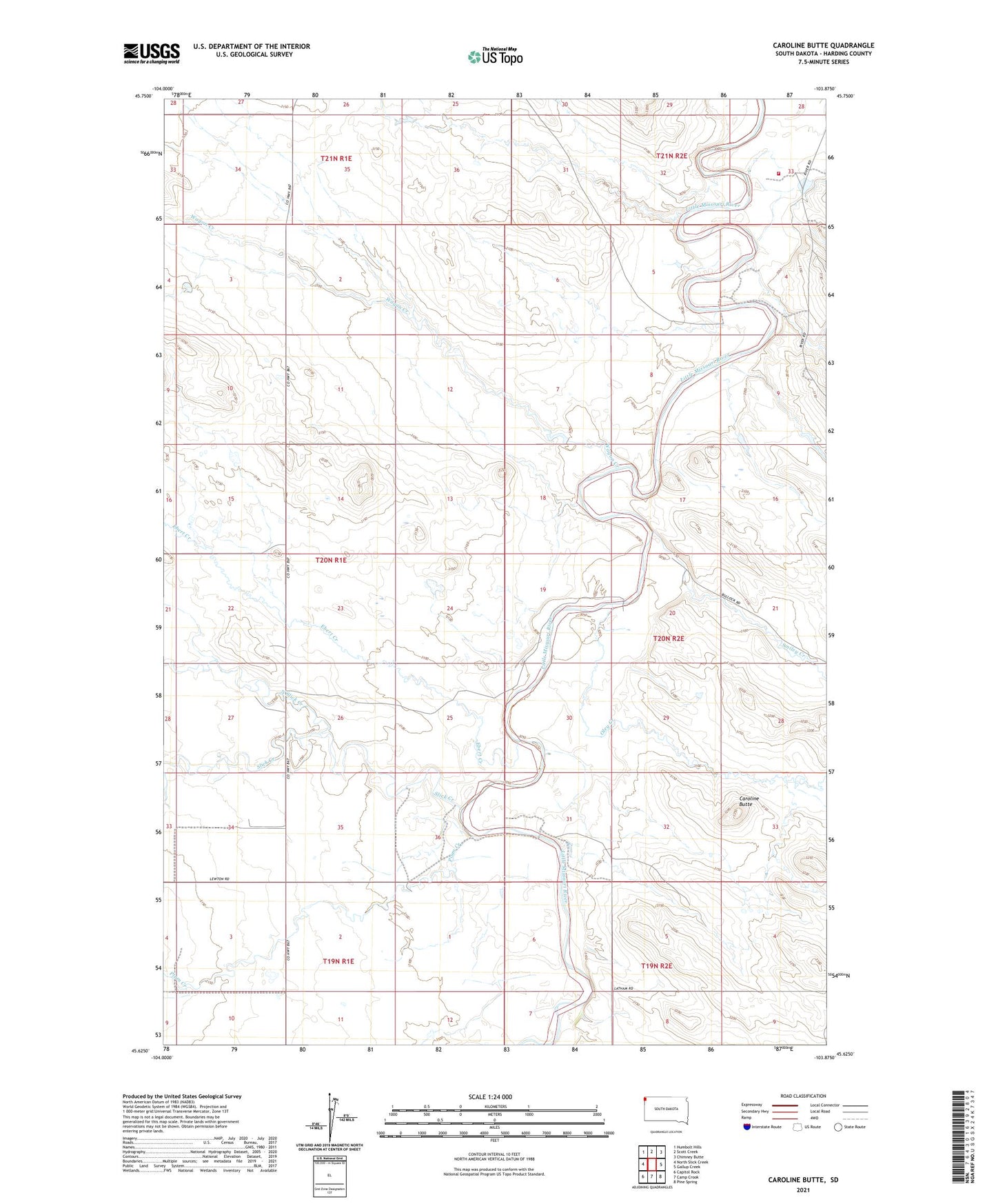
2021 topographic map quadrangle Caroline Butte in the state of South Dakota. Scale: 1:24000. Based on the newly updated USGS 7.5' US Topo map series, this map is in the following counties: Harding. The map contains contour data, water features, and other items you are used to seeing on USGS maps, but also has updated roads and other features. This is the next generation of topographic maps. Printed on high-quality waterproof paper with UV fade-resistant inks.
Quads adjacent to this one:
West: North Slick Creek
Northwest: Humbolt Hills
North: Scott Creek
Northeast: Chimney Butte
East: Gallup Creek
Southeast: Pine Spring
South: Camp Crook
Southwest: Capitol Rock
This map covers the same area as the classic USGS quad with code o45103f8.
Contains the following named places: Ashcroft, Caroline Butte, Ebert Creek, Latham Ranch, North Slick Creek, Oley Creek, Plum Creek, Slick Creek, Smiley Creek, Tarter Ranch, Township of Camp Crook, Township of Granger, Turbiville Ranch, Wagon Creek