MyTopo
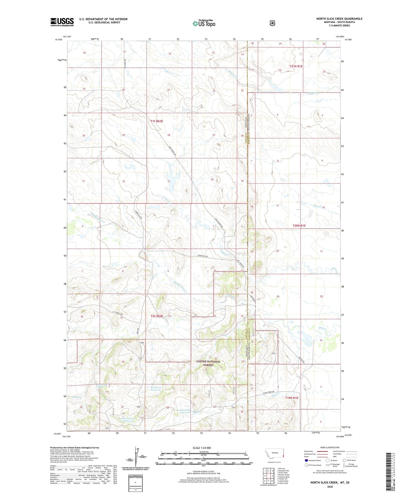
North Slick Creek Montana US Topo Map
Couldn't load pickup availability
Also explore the North Slick Creek Forest Service Topo of this same quad for updated USFS data
2024 topographic map quadrangle North Slick Creek in the states of Montana, South Dakota. Scale: 1:24000. Based on the newly updated USGS 7.5' US Topo map series, this map is in the following counties: Carter, Harding. The map contains contour data, water features, and other items you are used to seeing on USGS maps, but also has updated roads and other features. This is the next generation of topographic maps. Printed on high-quality waterproof paper with UV fade-resistant inks.
Quads adjacent to this one:
West: Rustler Divide
Northwest: Mill Iron
North: Humbolt Hills
Northeast: Scott Creek
East: Caroline Butte
Southeast: Camp Crook
South: Capitol Rock
Southwest: Timber Hill
Contains the following named places: 02S62E08DDDD01 Well, 57724, Bill Spring, Brown Jug Spring, Carter School, Custer National Forest - Sioux Division, Evenson Irrigation Dam, Evenson North Irrigation Dam, Gravel Pit Reservoir, Instant Tang Dam, Kool-Aid Dam, Lyle Lewton Dam, Middle Slick Creek, Midland, Midland Post Office, Midland School, Pendleton Reservoir, Pendleton Well, Plum Creek Well, Rolph Number 1 Dam, Section 21 Reservoir, West Plum Creek Reservoir