MyTopo
Toronto South Dakota US Topo Map
Couldn't load pickup availability
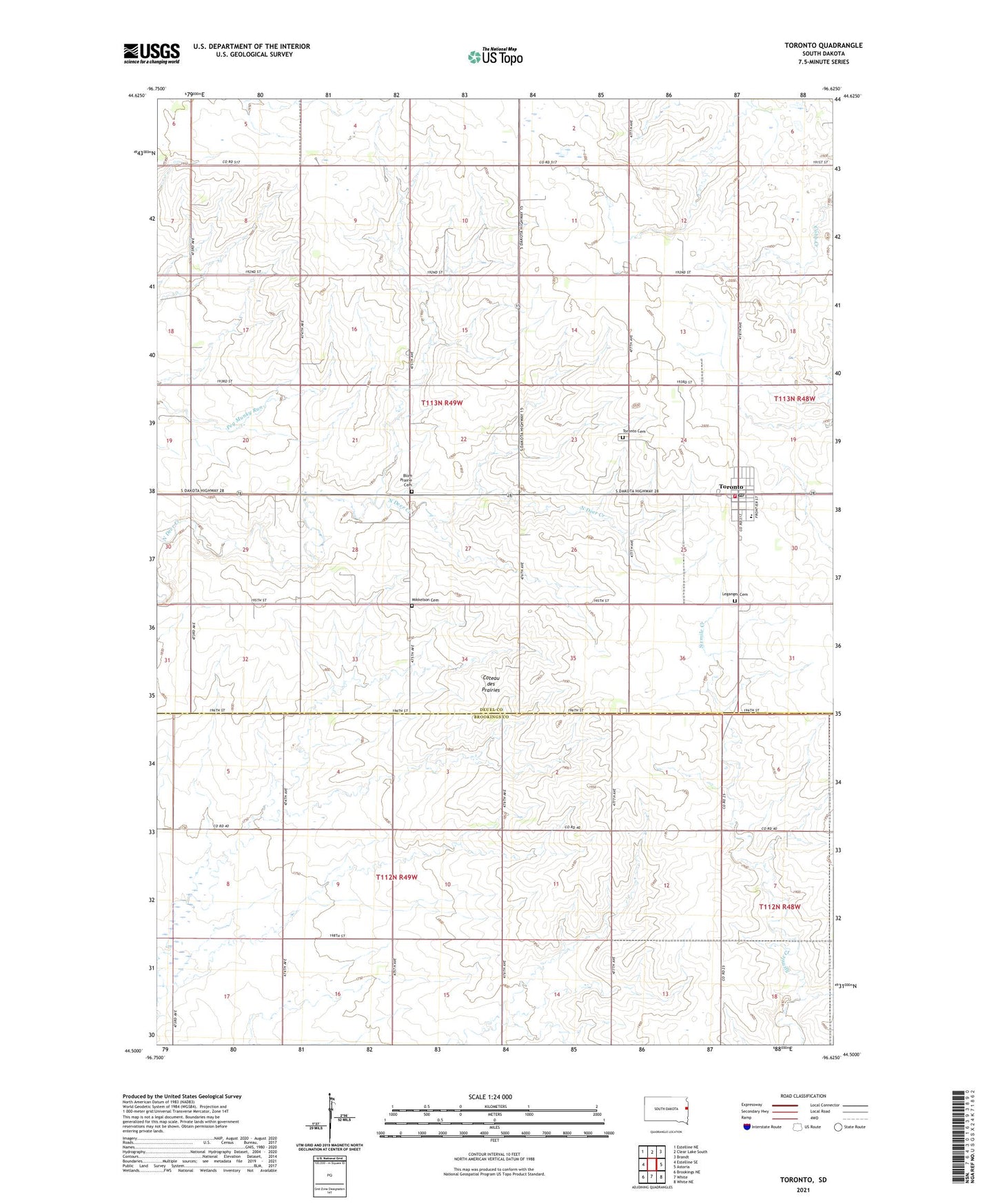
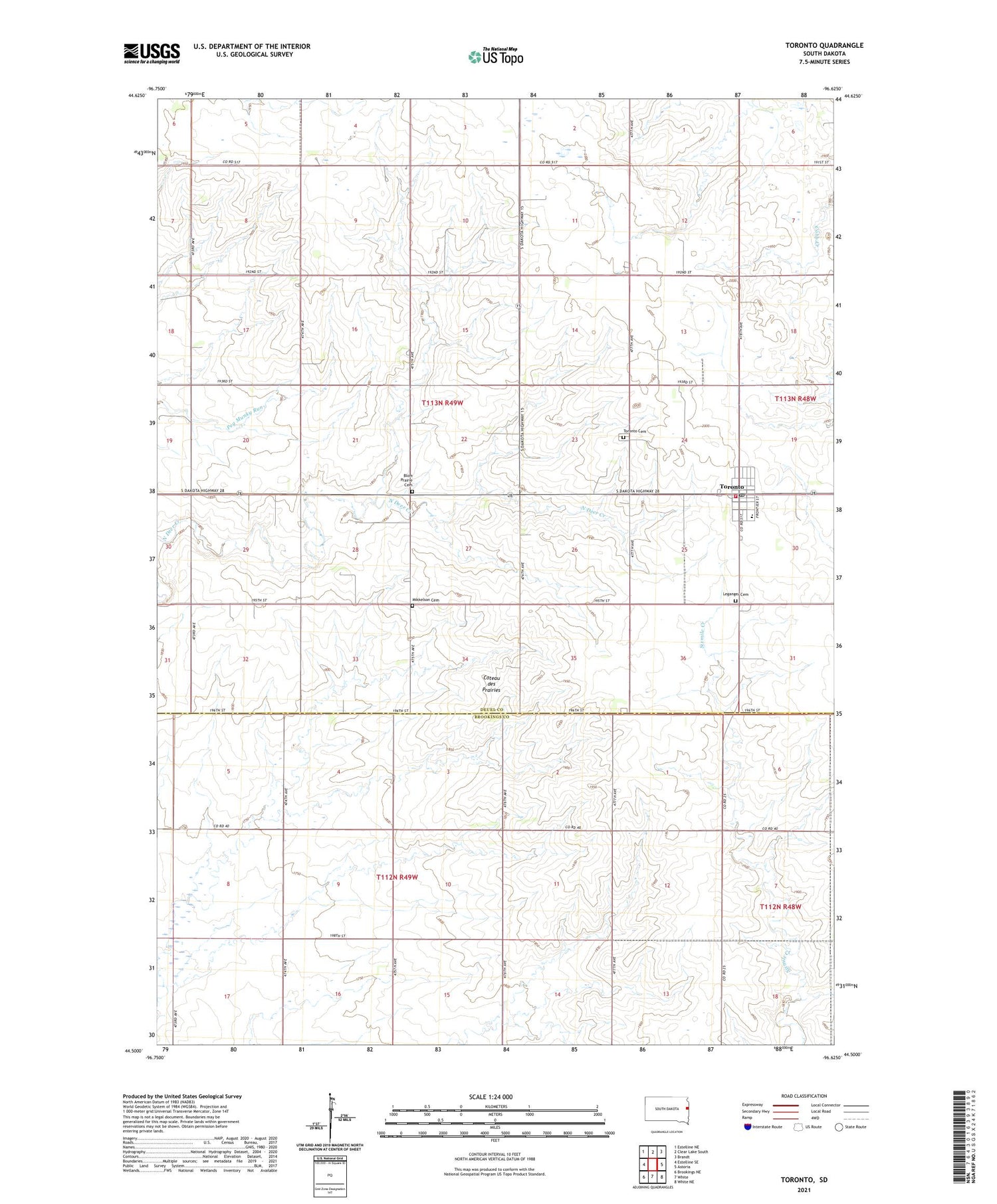
2021 topographic map quadrangle Toronto in the state of South Dakota. Scale: 1:24000. Based on the newly updated USGS 7.5' US Topo map series, this map is in the following counties: Deuel, Brookings. The map contains contour data, water features, and other items you are used to seeing on USGS maps, but also has updated roads and other features. This is the next generation of topographic maps. Printed on high-quality waterproof paper with UV fade-resistant inks.
Quads adjacent to this one:
West: Estelline SE
Northwest: Estelline NE
North: Clear Lake South
Northeast: Brandt
East: Astoria
Southeast: White NE
South: White
Southwest: Brookings NE
Contains the following named places: Argo, Argo District Number 24 School, Argo District Number 25 School, Argo District Number 53 School, Blom Prairie Cemetery, Leganger Cemetery, Lutheran Church, Mikkelson Cemetery, Mikkelson School, Red Willow Colony, Roosevelt School, Toronto, Toronto Cemetery, Toronto City Hall, Toronto Elementary School, Toronto Post Office, Toronto Volunteer Fire Department, Town of Toronto, Township of Blom, ZIP Code: 57268