MyTopo
Vale NE South Dakota US Topo Map
Couldn't load pickup availability
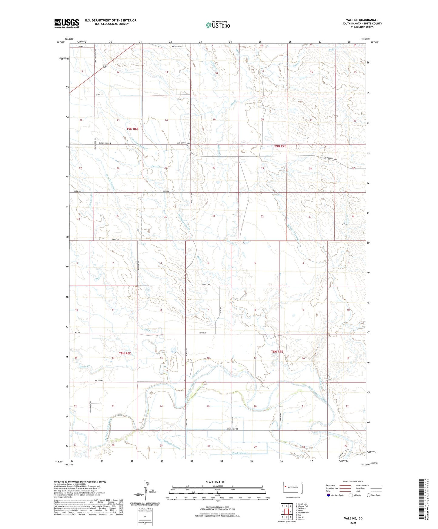
2021 topographic map quadrangle Vale NE in the state of South Dakota. Scale: 1:24000. Based on the newly updated USGS 7.5' US Topo map series, this map is in the following counties: Butte. The map contains contour data, water features, and other items you are used to seeing on USGS maps, but also has updated roads and other features. This is the next generation of topographic maps. Printed on high-quality waterproof paper with UV fade-resistant inks.
Quads adjacent to this one:
West: Newell
Northwest: Newell Lake
North: Schoepp Flat
Northeast: Owl Butte
East: Volunteer NW
Southeast: Volunteer
South: Vale SE
Southwest: Vale
This map covers the same area as the classic USGS quad with code o44103f3.
Contains the following named places: Antelope Lateral, Deer Creek, Dry Creek, Fairview School, Horse Creek, Hull Lateral, Jug Creek, Plainview School, Richards Lateral, Sand Creek, Sheffield Lateral, Webb School, Willow Creek, Willow Creek Lateral, Wood Lateral