MyTopo
Newell South Dakota US Topo Map
Couldn't load pickup availability
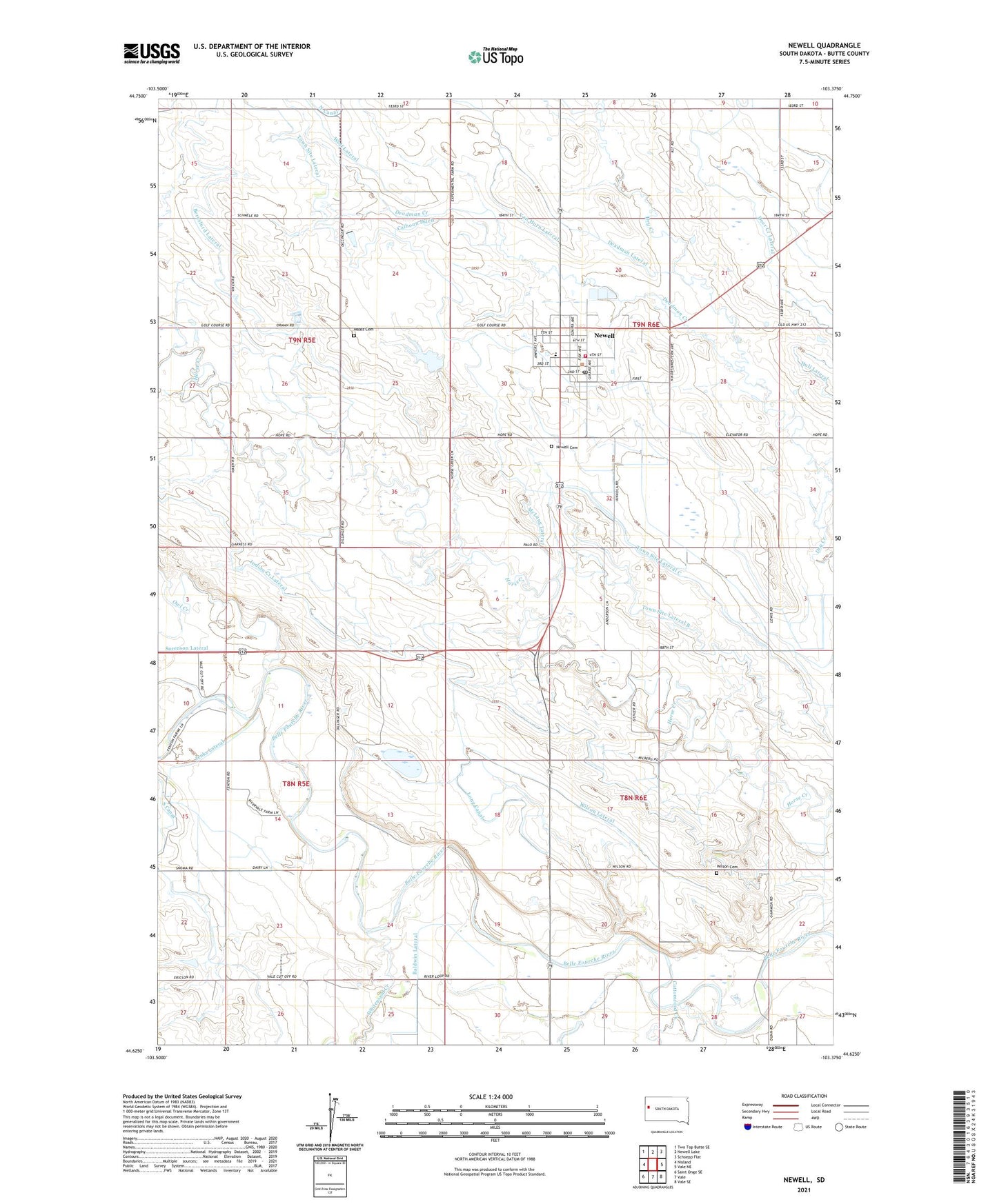
2021 topographic map quadrangle Newell in the state of South Dakota. Scale: 1:24000. Based on the newly updated USGS 7.5' US Topo map series, this map is in the following counties: Butte. The map contains contour data, water features, and other items you are used to seeing on USGS maps, but also has updated roads and other features. This is the next generation of topographic maps. Printed on high-quality waterproof paper with UV fade-resistant inks.
Quads adjacent to this one:
West: Nisland
Northwest: Two Top Butte SE
North: Newell Lake
Northeast: Schoepp Flat
East: Vale NE
Southeast: Vale SE
South: Vale
Southwest: Saint Onge SE
This map covers the same area as the classic USGS quad with code o44103f4.
Contains the following named places: Baldwin Lateral, Beresford Lateral, Butte County Ambulance Service Newell, Calhoun Ditch, City of Newell, Cottonwood Creek, Deadman Creek, Deadman Lateral, Deer Creek Lateral, Jenks Lateral, Langdon School, Long Canal, Maass Cemetery, McLung Lateral, Milberg School, Morsman Siding, Newell, Newell Airfield, Newell Cemetery, Newell City Hall, Newell Elementary School, Newell Experiment Station, Newell Fire Department, Newell High School, Newell Middle School, Newell Museum, Newell Police Department, Newell Post Office, Newell Public Library, Owl Creek, Riverside School, South Canal, Town Site Lateral, Town Site Lateral A, Town Site Lateral B, Town Site Lateral C, Van Horn Lateral, Whitewood Creek, Wilson Cemetery, Wilson Lateral, Wolf Lateral