MyTopo
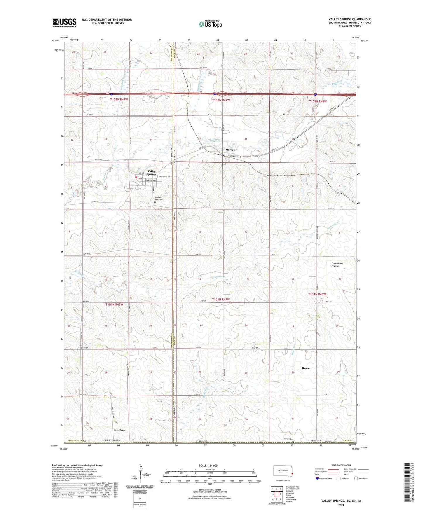
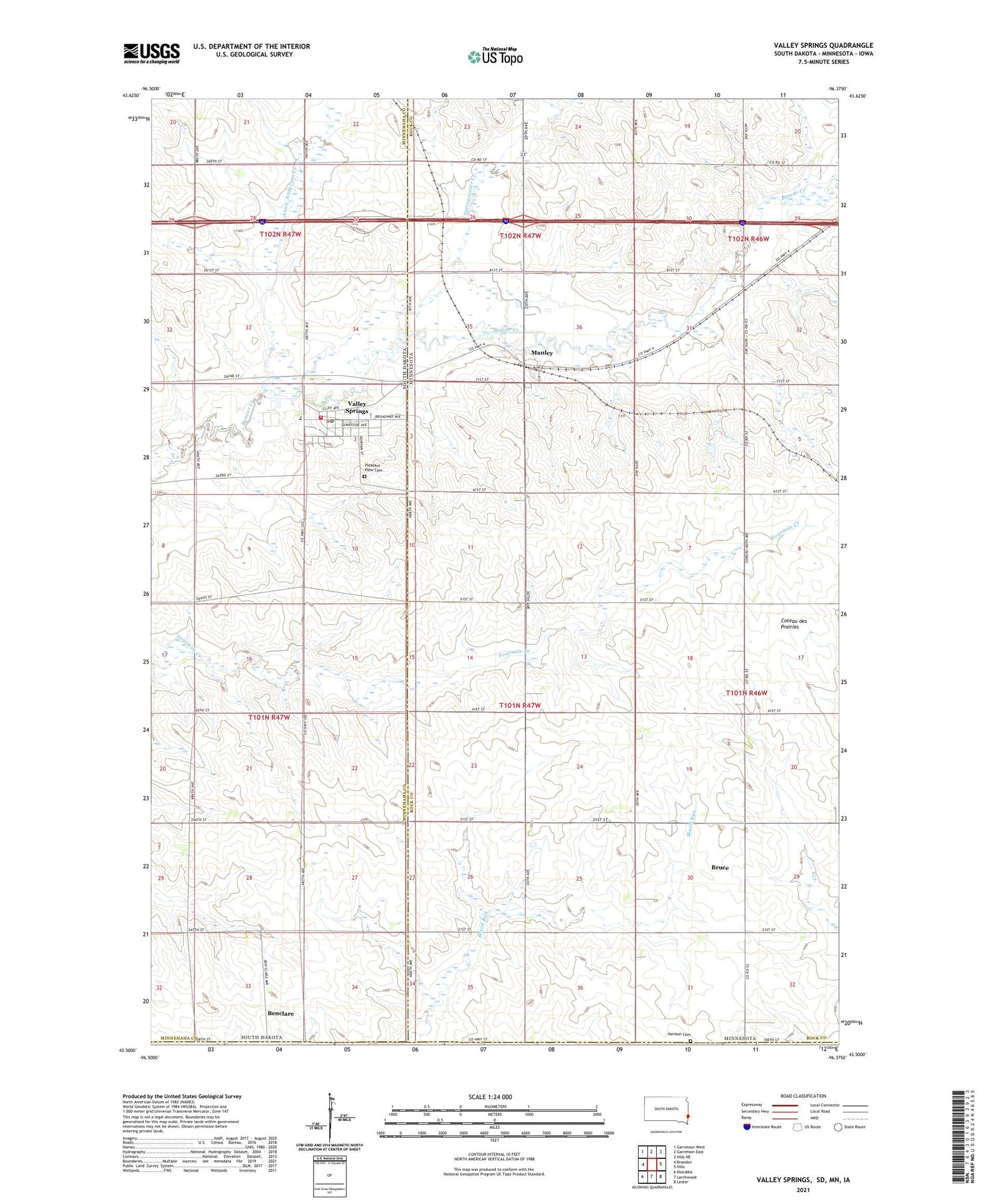
Valley Springs South Dakota US Topo Map
Couldn't load pickup availability
2021 topographic map quadrangle Valley Springs in the states of Minnesota, South Dakota. Scale: 1:24000. Based on the newly updated USGS 7.5' US Topo map series, this map is in the following counties: Minnehaha, Rock, Lyon. The map contains contour data, water features, and other items you are used to seeing on USGS maps, but also has updated roads and other features. This is the next generation of topographic maps. Printed on high-quality waterproof paper with UV fade-resistant inks.
Quads adjacent to this one:
West: Brandon
Northwest: Garretson West
North: Garretson East
Northeast: Hills NE
East: Hills
Southeast: Lester
South: Larchwood
Southwest: Klondike
Contains the following named places: Annie Anderson Creek, Benclare, Bruce, Bruce Post Office, City of Valley Springs, Manley, Manley Post Office, Nerison Cemetery, Pleasant View Cemetery, South Dakota Highway Patrol - Sioux Falls Port of Entry, Springwater Creek, Township of Valley Springs, Valley Springs, Valley Springs Branch Library, Valley Springs City Hall, Valley Springs Elementary School, Valley Springs Fire Department, Valley Springs Post Office, ZIP Codes: 56116, 56138, 57068