MyTopo
Garretson West South Dakota US Topo Map
Couldn't load pickup availability
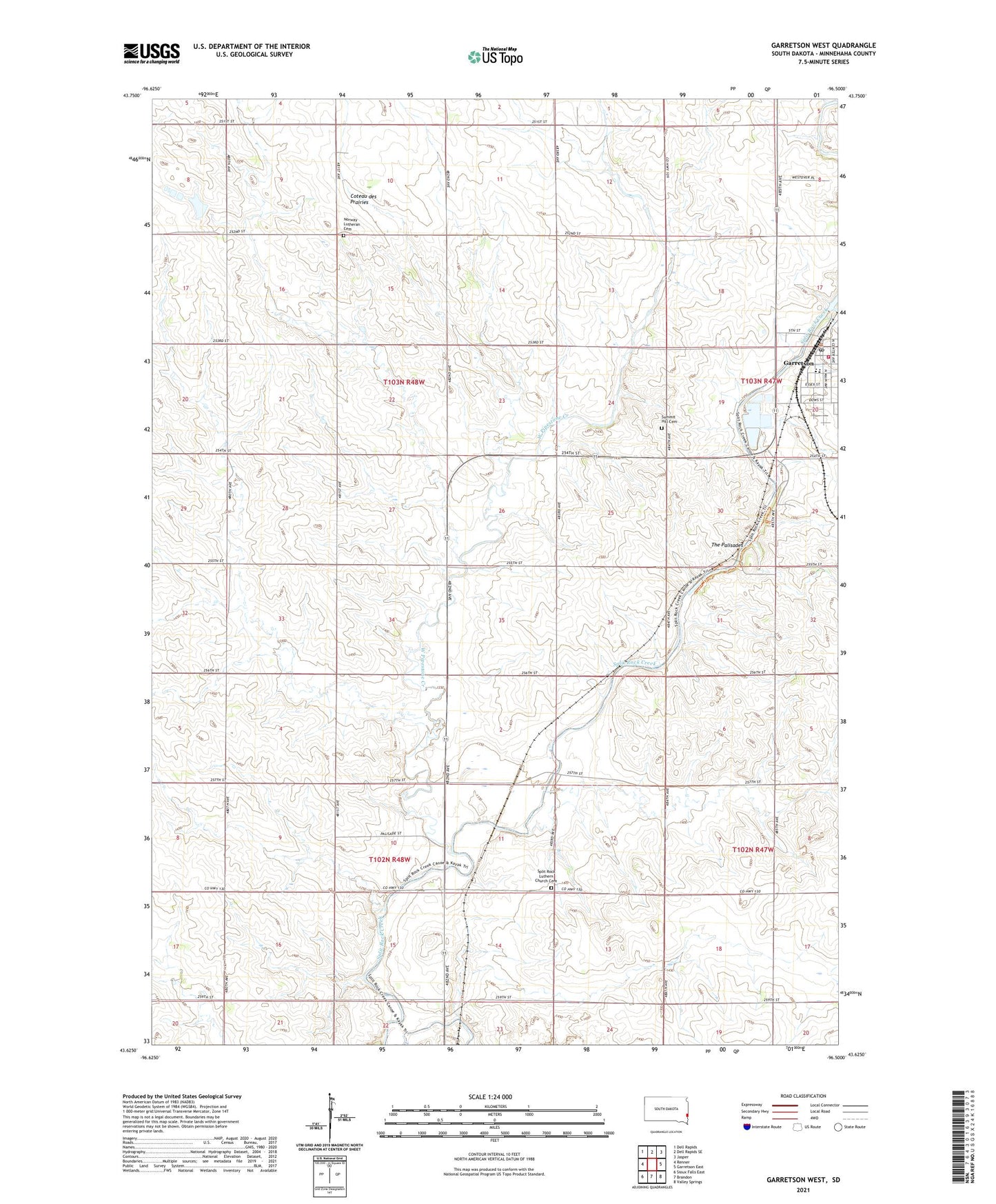
2021 topographic map quadrangle Garretson West in the state of South Dakota. Scale: 1:24000. Based on the newly updated USGS 7.5' US Topo map series, this map is in the following counties: Minnehaha. The map contains contour data, water features, and other items you are used to seeing on USGS maps, but also has updated roads and other features. This is the next generation of topographic maps. Printed on high-quality waterproof paper with UV fade-resistant inks.
Quads adjacent to this one:
West: Renner
Northwest: Dell Rapids
North: Dell Rapids SE
Northeast: Jasper
East: Garretson East
Southeast: Valley Springs
South: Brandon
Southwest: Sioux Falls East
This map covers the same area as the classic USGS quad with code o43096f5.
Contains the following named places: City of Garretson, Devils Gulch, EROS Data Center, Fairview School, Garretson, Garretson Area Historical Society Museum, Garretson Branch Library, Garretson City Hall, Garretson Elementary School, Garretson High School, Garretson Middle School, Garretson Police Department, Garretson Post Office, Garretson Volunteer Fire Department, Norway Lutheran Cemetery, Palisade, Palisades Recreational Area, Split Rock Church, Split Rock Luthern Church Cemetery, Split Rock Park, Summit Hill Cemetery, The Palisades, Township of Brandon, Township of Edison, West Pipestone Creek, White Willow School, ZIP Code: 57030