MyTopo
Brandon South Dakota US Topo Map
Couldn't load pickup availability
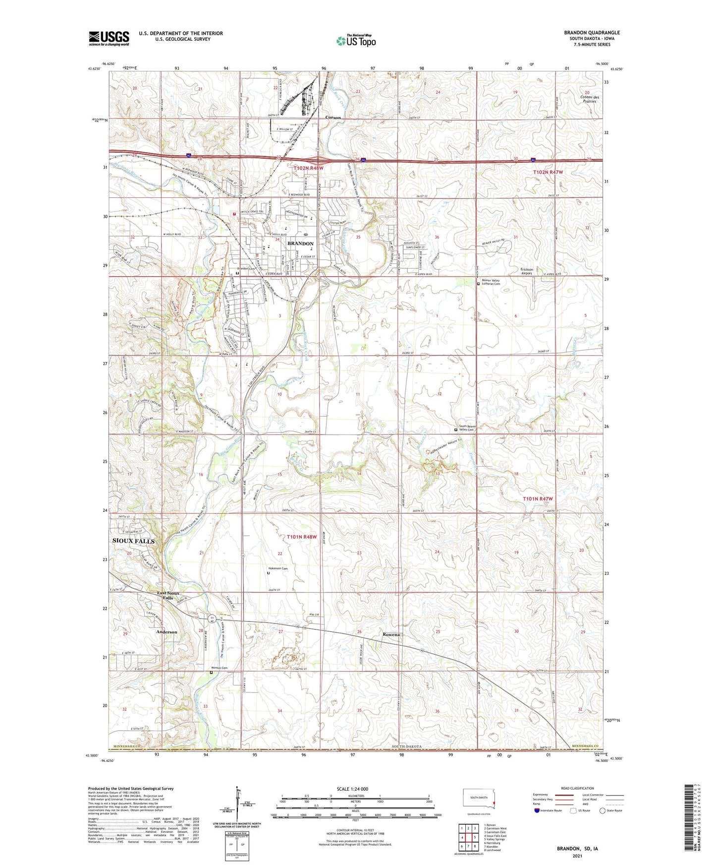
2021 topographic map quadrangle Brandon in the state of South Dakota. Scale: 1:24000. Based on the newly updated USGS 7.5' US Topo map series, this map is in the following counties: Minnehaha, Lyon, Lincoln. The map contains contour data, water features, and other items you are used to seeing on USGS maps, but also has updated roads and other features. This is the next generation of topographic maps. Printed on high-quality waterproof paper with UV fade-resistant inks.
Quads adjacent to this one:
West: Sioux Falls East
Northwest: Renner
North: Garretson West
Northeast: Garretson East
East: Valley Springs
Southeast: Larchwood
South: Klondike
Southwest: Harrisburg
This map covers the same area as the classic USGS quad with code o43096e5.
Contains the following named places: Anderson Census Designated Place, Assam Dam, Beaver Creek, Beaver Valley Church, Beaver Valley Lutheran Cemetery, Brandon, Brandon Branch Library, Brandon Cemetery, Brandon City Hall, Brandon Elementary School, Brandon Fire Department, Brandon Police Department, Brandon Post Office, Brandon Valley High School, Brandon Valley Middle School, City of Brandon, Corson, East Sioux Falls, Erickson Airport, Fourmile Creek, Hokenson Cemetery, Indian Hill Division, KELO-FM (Sioux Falls), KNWC-FM (Sioux Falls), Med - Star Paramedic Ambulance, Monson Cemetery, Robert Bennis Elementary School, Rowena, Rowena Census Designated Place, South Beaver Valley Cemetery, Split Rock, Split Rock Creek, Township of Split Rock, ZIP Code: 57005