MyTopo
Garretson East South Dakota US Topo Map
Couldn't load pickup availability
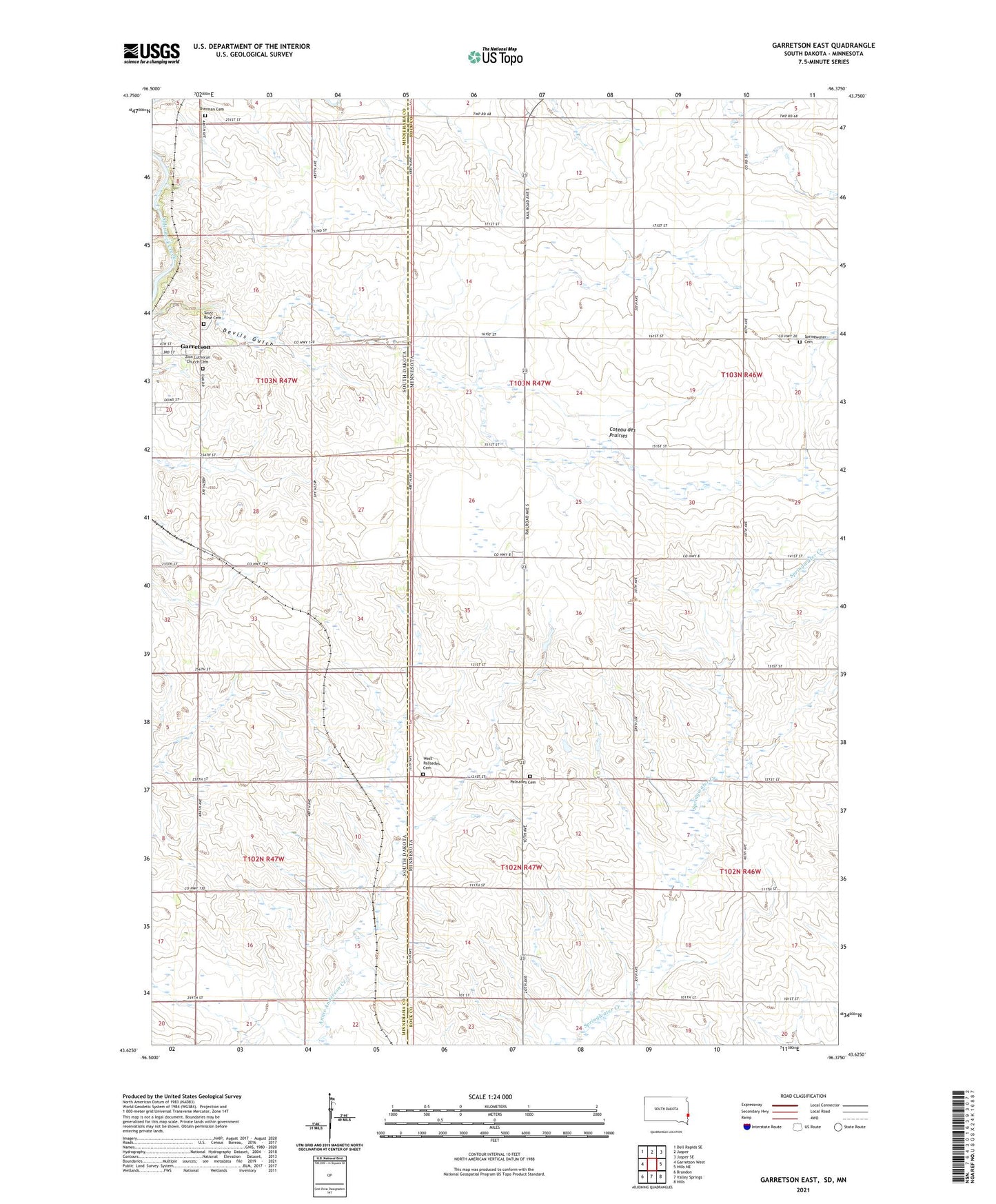
2021 topographic map quadrangle Garretson East in the states of Minnesota, South Dakota. Scale: 1:24000. Based on the newly updated USGS 7.5' US Topo map series, this map is in the following counties: Minnehaha, Rock. The map contains contour data, water features, and other items you are used to seeing on USGS maps, but also has updated roads and other features. This is the next generation of topographic maps. Printed on high-quality waterproof paper with UV fade-resistant inks.
Quads adjacent to this one:
West: Garretson West
Northwest: Dell Rapids SE
North: Jasper
Northeast: Jasper SE
East: Hills NE
Southeast: Hills
South: Valley Springs
Southwest: Brandon
This map covers the same area as the classic USGS quad with code o43096f4.
Contains the following named places: Booge, Garretson Community Ambulance, Oak Park Estates, Palisades Cemetery, Palisades Church, Saint Rose Cemetery, Sherman Cemetery, Springwater Cemetery, Township of Palisade, Township of Red Rock, West Palisades Cemetery, Zion Lutheran Church Cemetery