MyTopo
Vivian South Dakota US Topo Map
Couldn't load pickup availability
Also explore the Vivian Forest Service Topo of this same quad for updated USFS data
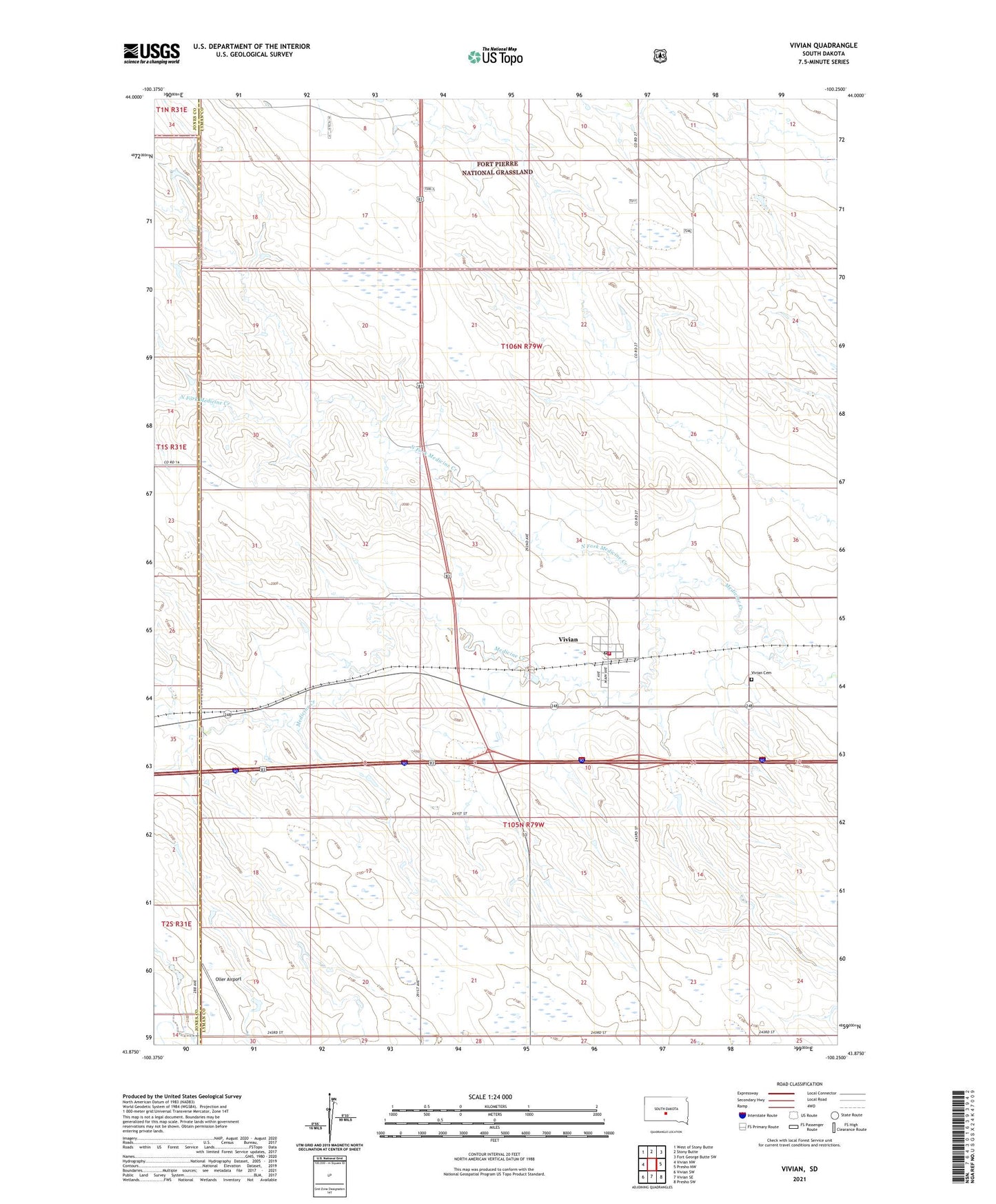
2021 topographic map quadrangle Vivian in the state of South Dakota. Scale: 1:24000. Based on the newly updated USGS 7.5' US Topo map series, this map is in the following counties: Lyman, Jones. The map contains contour data, water features, and other items you are used to seeing on USGS maps, but also has updated roads and other features. This is the next generation of topographic maps. Printed on high-quality waterproof paper with UV fade-resistant inks.
Quads adjacent to this one:
West: Vivian NW
Northwest: West of Stony Butte
North: Stony Butte
Northeast: Fort George Butte SW
East: Presho NW
Southeast: Presho SW
South: Vivian SE
Southwest: Vivian SW
This map covers the same area as the classic USGS quad with code o43100h3.
Contains the following named places: Medicine Creek Roadside Park, North Fork Medicine Creek, Oller Airport, Township of Vivian, Vivian, Vivian Cemetery, Vivian Census Designated Place, Vivian Dam, Vivian Fire Department, Vivian Fire Department Substation, Vivian Landing Strip, Vivian Post Office, ZIP Code: 57576