MyTopo
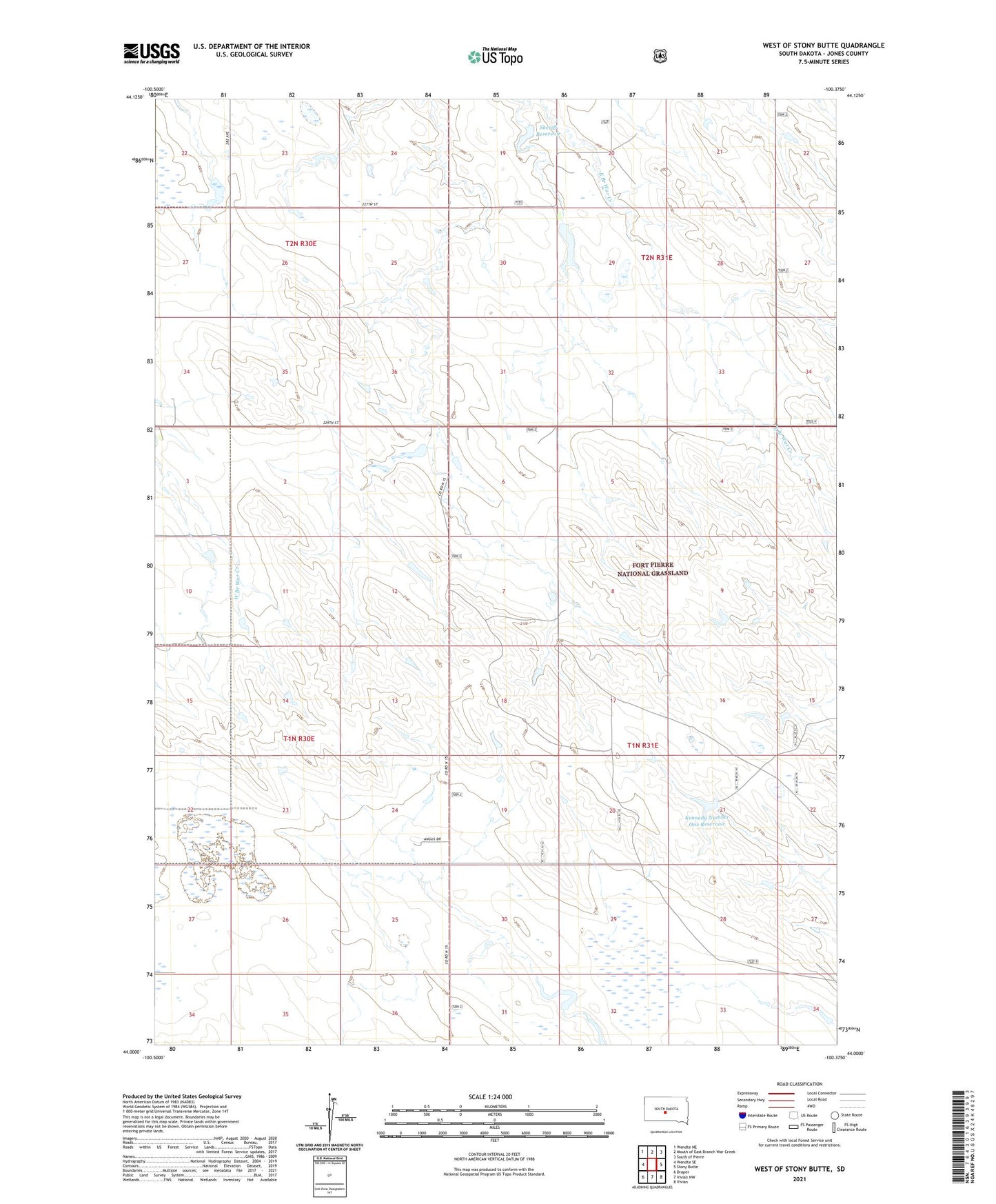
West of Stony Butte South Dakota US Topo Map
Couldn't load pickup availability
Also explore the West of Stony Butte Forest Service Topo of this same quad for updated USFS data
2021 topographic map quadrangle West of Stony Butte in the state of South Dakota. Scale: 1:24000. Based on the newly updated USGS 7.5' US Topo map series, this map is in the following counties: Jones. The map contains contour data, water features, and other items you are used to seeing on USGS maps, but also has updated roads and other features. This is the next generation of topographic maps. Printed on high-quality waterproof paper with UV fade-resistant inks.
Quads adjacent to this one:
West: Wendte SE
Northwest: Wendte NE
North: Mouth of East Branch War Creek
Northeast: South of Pierre
East: Stony Butte
Southeast: Vivian
South: Vivian NW
Southwest: Draper
This map covers the same area as the classic USGS quad with code o44100a4.
Contains the following named places: Booth Number 1 Dam, Engen Dam, Engen Reservoir, Kennedy Number 1 Dam, Kennedy Number One Reservoir, Leir, Sheriff Dam, Sheriff Number 1 Dam, Sheriff Reservoir, Stockton Number 1 Dam, Township of Rich Valley, Township of Richland, Township of War Creek, Unorganized Territory of Rich Valley