MyTopo
Webster South Dakota US Topo Map
Couldn't load pickup availability
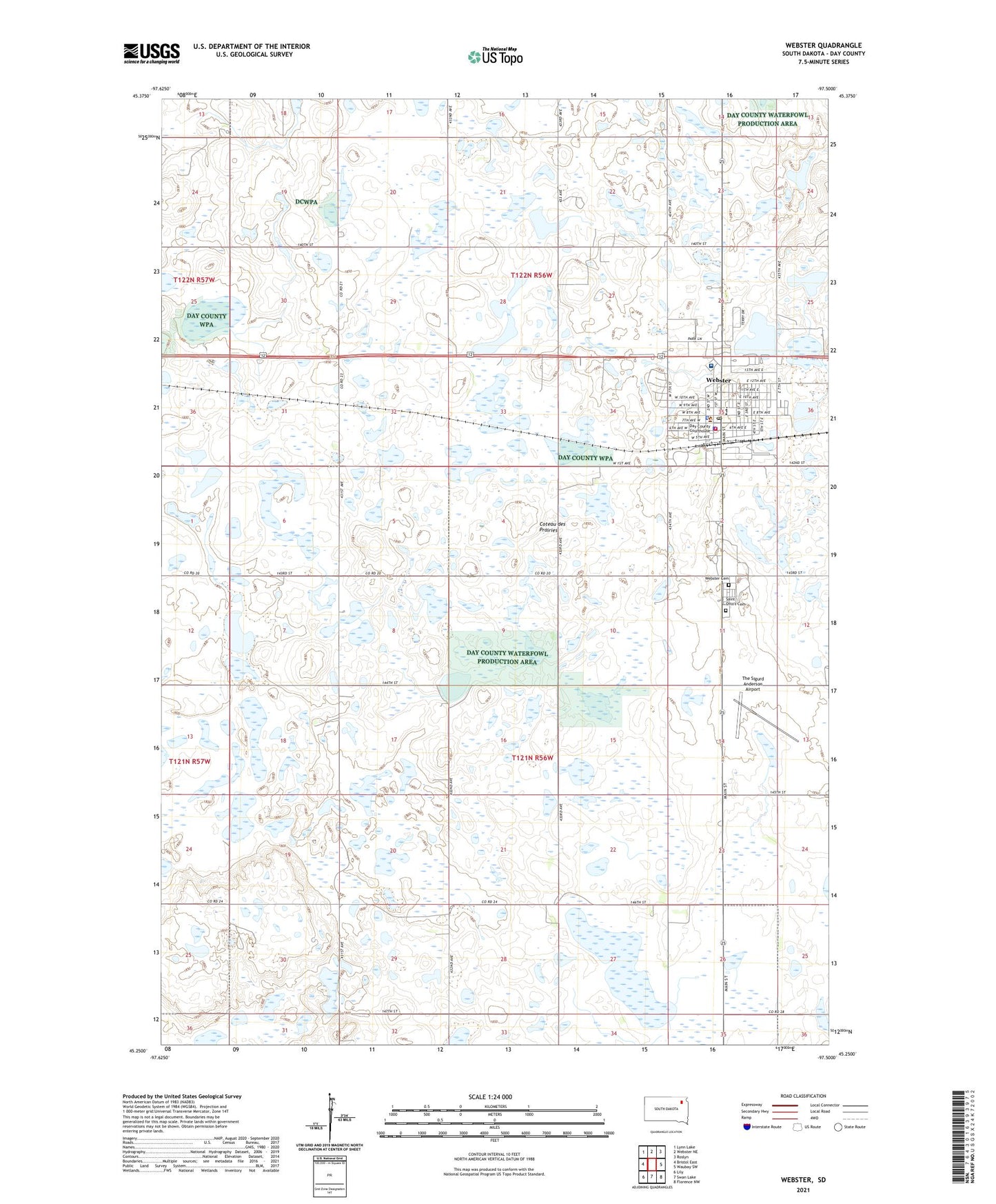
2021 topographic map quadrangle Webster in the state of South Dakota. Scale: 1:24000. Based on the newly updated USGS 7.5' US Topo map series, this map is in the following counties: Day. The map contains contour data, water features, and other items you are used to seeing on USGS maps, but also has updated roads and other features. This is the next generation of topographic maps. Printed on high-quality waterproof paper with UV fade-resistant inks.
Quads adjacent to this one:
West: Bristol East
Northwest: Lynn Lake
North: Webster NE
Northeast: Roslyn
East: Waubay SW
Southeast: Florence NW
South: Swan Lake
Southwest: Lily
This map covers the same area as the classic USGS quad with code o45097c5.
Contains the following named places: Buchner Slough, Buchner Slough State Public Shooting Area, Christensen Ambulance Service, Christensen Ambulance Service Station 1, City of Webster, Day County, Day County Courthouse, Day County Sheriff's Office, Saint Otto's Cemetery, Sanford Hospital Webster, The Sigurd Anderson Airport, Township of Rusk, Township of Webster, Webster, Webster Area Elementary School, Webster Area High School, Webster Area Middle School, Webster Cemetery, Webster City Hall, Webster City Police, Webster Post Office, Webster Public Library, Webster Volunteer Fire Department, ZIP Code: 57274