MyTopo
Bristol East South Dakota US Topo Map
Couldn't load pickup availability
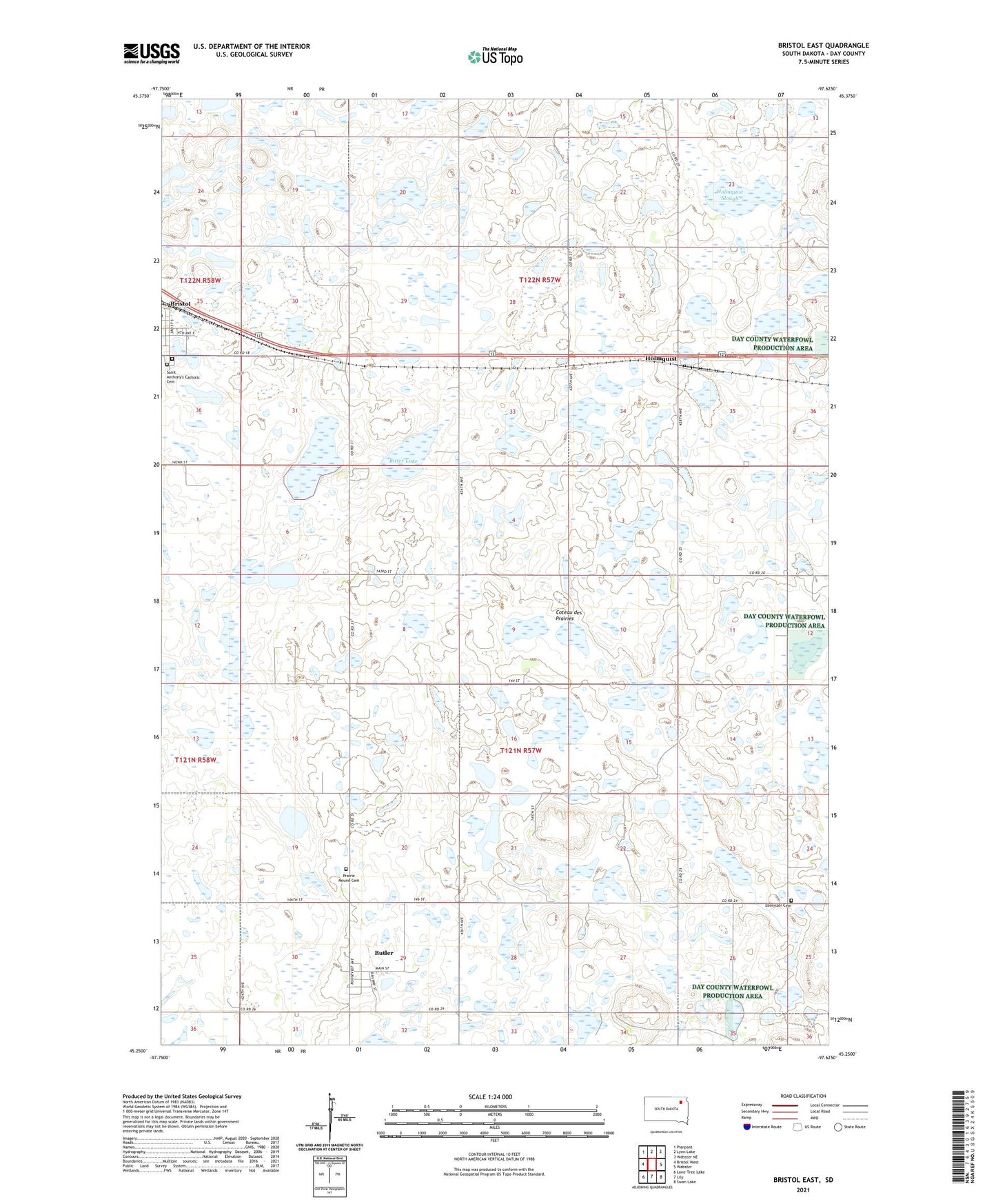
2021 topographic map quadrangle Bristol East in the state of South Dakota. Scale: 1:24000. Based on the newly updated USGS 7.5' US Topo map series, this map is in the following counties: Day. The map contains contour data, water features, and other items you are used to seeing on USGS maps, but also has updated roads and other features. This is the next generation of topographic maps. Printed on high-quality waterproof paper with UV fade-resistant inks.
Quads adjacent to this one:
West: Bristol West
Northwest: Pierpont
North: Lynn Lake
Northeast: Webster NE
East: Webster
Southeast: Swan Lake
South: Lily
Southwest: Lone Tree Lake
This map covers the same area as the classic USGS quad with code o45097c6.
Contains the following named places: Bitter Lake, Bristol, Bristol Cemetery, Butler, City of Bristol, Ebenezer Cemetery, Holmquist, Holmquist Slough, Holmquist Slough State Public Shooting Area, Prairie Mound Cemetery, Saint Anthony's Catholic Cemetery, Town of Butler, Township of Butler, Township of Kidder