MyTopo
White River NE South Dakota US Topo Map
Couldn't load pickup availability
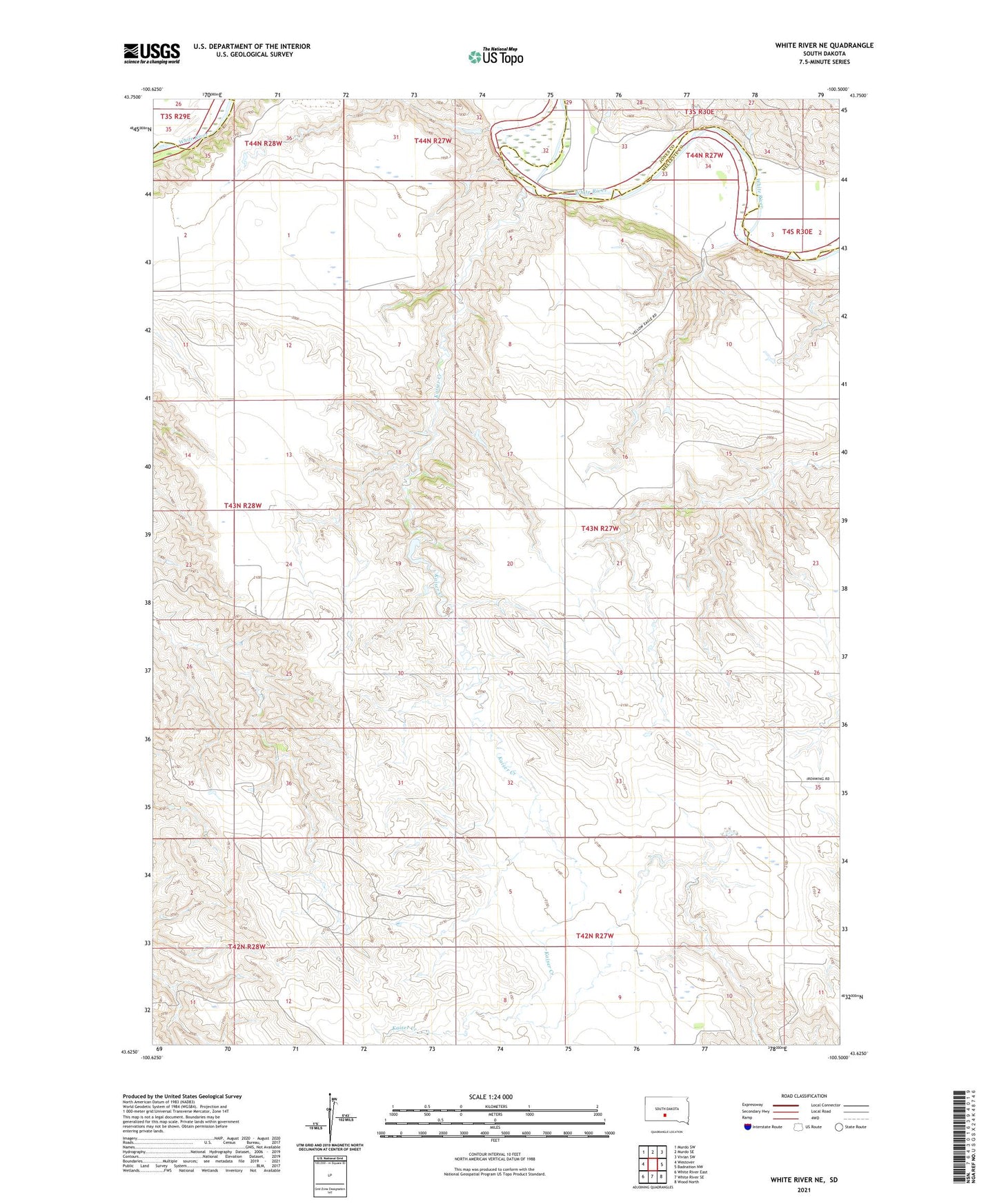
2021 topographic map quadrangle White River NE in the state of South Dakota. Scale: 1:24000. Based on the newly updated USGS 7.5' US Topo map series, this map is in the following counties: Mellette, Jones. The map contains contour data, water features, and other items you are used to seeing on USGS maps, but also has updated roads and other features. This is the next generation of topographic maps. Printed on high-quality waterproof paper with UV fade-resistant inks.
Quads adjacent to this one:
West: Westover
Northwest: Murdo SW
North: Murdo SE
Northeast: Vivian SW
East: Badnation NW
Southeast: Wood North
South: White River SE
Southwest: White River East
This map covers the same area as the classic USGS quad with code o43100f5.
Contains the following named places: Brost Number 1 Dam, Brost Number 2 Dam, Edwards Cattle Company Number 1 Dam, Kaiser Creek, Paleck School, Prosperity Flats School, Township of Cody