MyTopo
White River East South Dakota US Topo Map
Couldn't load pickup availability
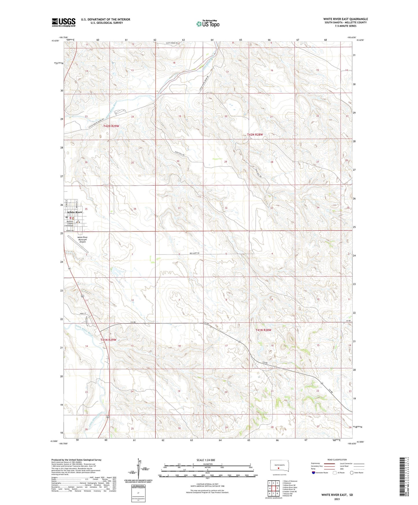
2021 topographic map quadrangle White River East in the state of South Dakota. Scale: 1:24000. Based on the newly updated USGS 7.5' US Topo map series, this map is in the following counties: Mellette. The map contains contour data, water features, and other items you are used to seeing on USGS maps, but also has updated roads and other features. This is the next generation of topographic maps. Printed on high-quality waterproof paper with UV fade-resistant inks.
Quads adjacent to this one:
West: White River West
Northwest: West of Westover
North: Westover
Northeast: White River NE
East: White River SE
Southeast: Mission NE
South: Mission NW
Southwest: Soldier Creek NE
This map covers the same area as the classic USGS quad with code o43100e6.
Contains the following named places: Bak Number 1 Dam, Charles Hight Ranch, City of White River, Clifford Hight Ranch, Didier Ranch, Dolezal Ranch, Ellis Ranch, Floyd Valburg Ranch, Gene Strain Ranch, Highway 44 Number 4 Dam, Highway Department Number 2 Dam, Horse Creek Census Designated Place, Hutchinson Ranch, Krogman Lawrence Number 3 Dam, Little Badlands, Mellette County Ambulance, Mellette County Courthouse, Mellette County Jail, Mellette County Sheriff's Office, Nohrenberg Number 3 Dam, Nohrenberg Ranch, Petranek Number 1 Dam, Schoppert Ranch, Stromer Herman Number 2 Dam, Unorganized Territory of Central Mellette, White River, White River City Hall, White River Community Events Center, White River Elementary School, White River Fire Department, White River High School, White River Middle School, White River Municipal Airport, White River Post Office