MyTopo
Menno South Dakota US Topo Map
Couldn't load pickup availability
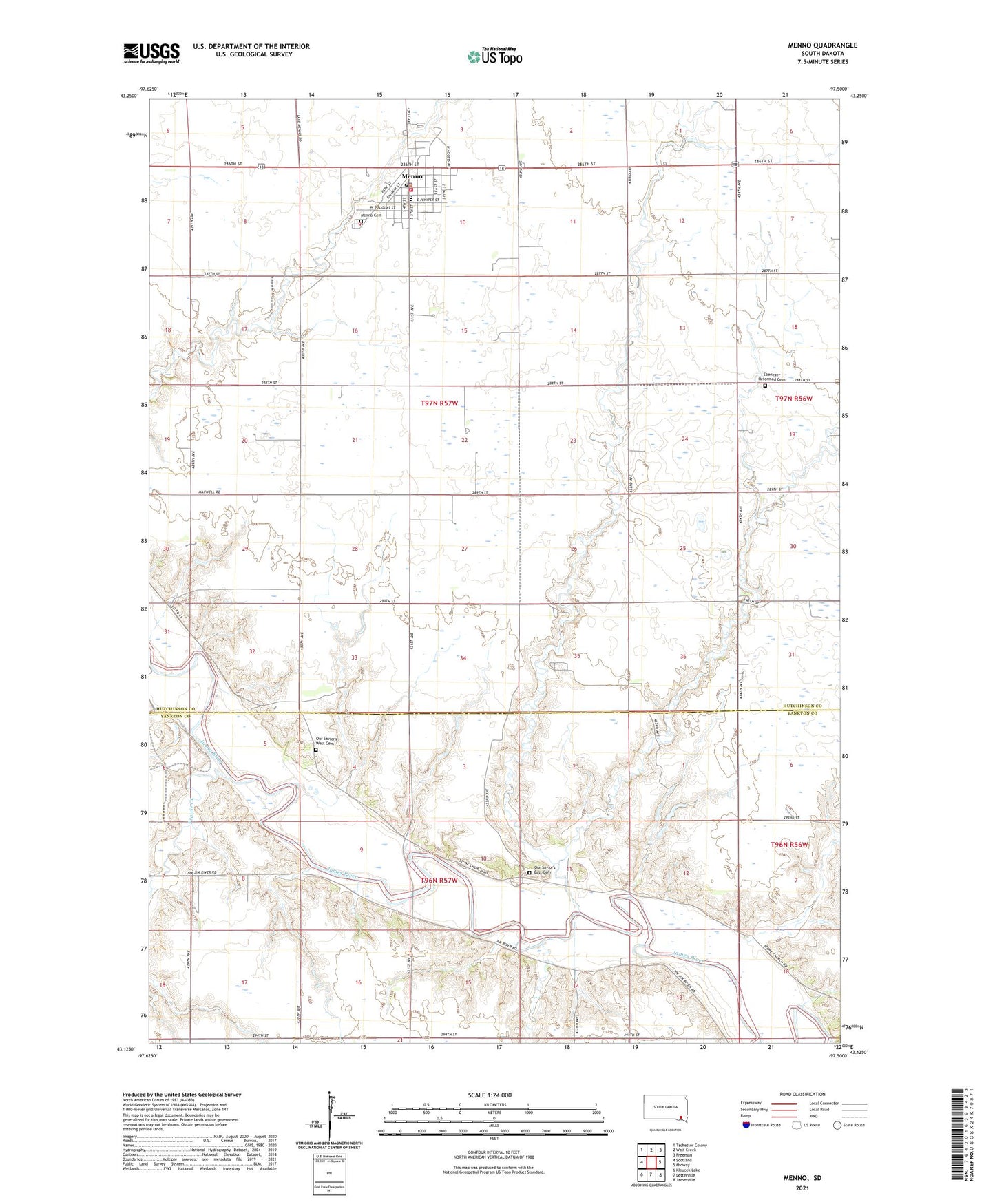
2021 topographic map quadrangle Menno in the state of South Dakota. Scale: 1:24000. Based on the newly updated USGS 7.5' US Topo map series, this map is in the following counties: Hutchinson, Yankton. The map contains contour data, water features, and other items you are used to seeing on USGS maps, but also has updated roads and other features. This is the next generation of topographic maps. Printed on high-quality waterproof paper with UV fade-resistant inks.
Quads adjacent to this one:
West: Scotland
Northwest: Tschetter Colony
North: Wolf Creek
Northeast: Freeman
East: Midway
Southeast: Jamesville
South: Lesterville
Southwest: Kloucek Lake
This map covers the same area as the classic USGS quad with code o43097b5.
Contains the following named places: City of Menno, East View School, Ebenezer Church, Ebenezer Reformed Cemetery, Klaudt School, Menno, Menno Airport, Menno Ambulance Service, Menno Cemetery, Menno City Hall, Menno Community/School Library, Menno Elementary School, Menno High School, Menno Middle School, Menno Police Department, Menno Post Office, Menno Volunteer Fire Department, Norway, Norway School, Our Savior's East Cemetery, Our Savior's West Cemetery, Our Saviours Church, Prairie Creek, Stoller School, Township of Menno, Township of Odessa, Township of Sweet, Zeeb School, ZIP Code: 57045