MyTopo
Worthing South Dakota US Topo Map
Couldn't load pickup availability
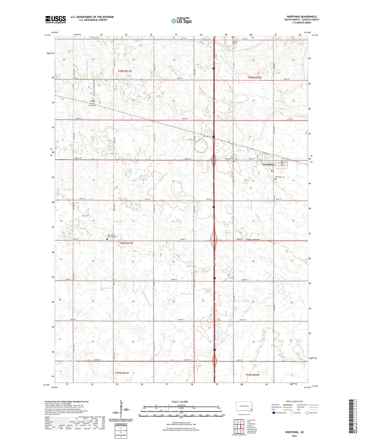
2021 topographic map quadrangle Worthing in the state of South Dakota. Scale: 1:24000. Based on the newly updated USGS 7.5' US Topo map series, this map is in the following counties: Lincoln. The map contains contour data, water features, and other items you are used to seeing on USGS maps, but also has updated roads and other features. This is the next generation of topographic maps. Printed on high-quality waterproof paper with UV fade-resistant inks.
Quads adjacent to this one:
West: Lennox
Northwest: Lennox NW
North: Tea
Northeast: Harrisburg
East: Canton SW
Southeast: Alcester NW
South: Beresford NE
Southwest: Beresford NW
Contains the following named places: Bennett School, City of Worthing, Crowley School, Ditch Number 14, Ditch Number Eight, Ditch Number Four, Faith LaValley Cemetery, Gedstad School, Hill School, Lake Albert, Maple Grove, Miller School, Mount Olivet Cemetery, Nelson School, Saint Edwards Cemetery, Sherman School, Skie Air Service Landing Field, Township of Grant, West Prairie Church, West Prairie Lutheran Cemetery, Worthing, Worthing Cemetery, Worthing City Hall, Worthing Elementary School, Worthing Fire Department, Worthing Police Department, Worthing Post Office, ZIP Codes: 57039, 57077