MyTopo
Lennox NW South Dakota US Topo Map
Couldn't load pickup availability
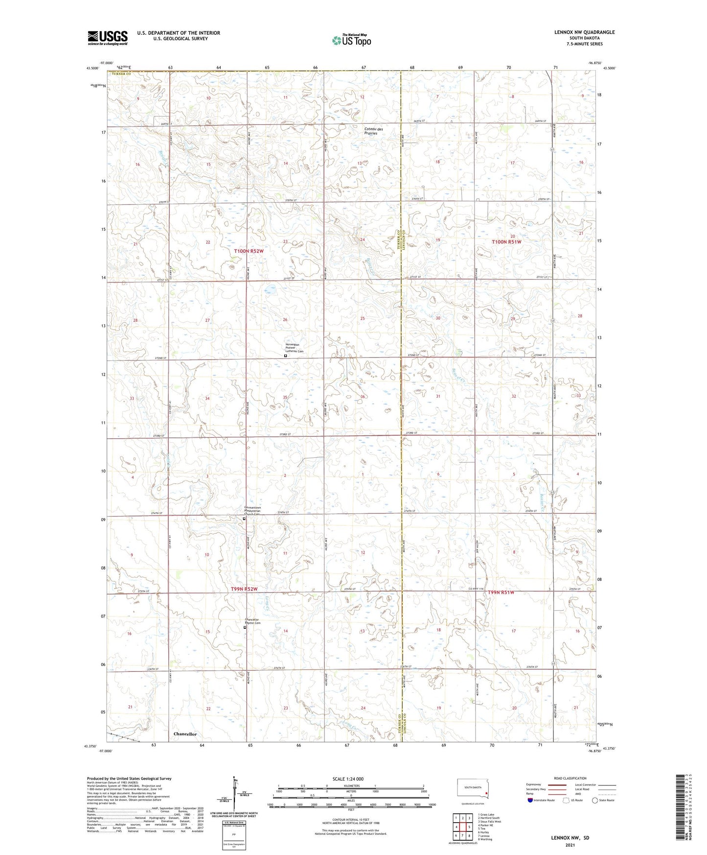
2021 topographic map quadrangle Lennox NW in the state of South Dakota. Scale: 1:24000. Based on the newly updated USGS 7.5' US Topo map series, this map is in the following counties: Turner, Lincoln, Minnehaha. The map contains contour data, water features, and other items you are used to seeing on USGS maps, but also has updated roads and other features. This is the next generation of topographic maps. Printed on high-quality waterproof paper with UV fade-resistant inks.
Quads adjacent to this one:
West: Parker NE
Northwest: Grass Lake
North: Hartford South
Northeast: Sioux Falls West
East: Tea
Southeast: Worthing
South: Lennox
Southwest: Hurley
This map covers the same area as the classic USGS quad with code o43096d8.
Contains the following named places: Berens School, Chancellor Baptist Cemetery, Dirksen School, German Baptist Church, Germantown Church, Germantown Presbyterian Church Cemetery, Goldenrod School, Home, Home School, Norwegian Pioneer Lutheran Cemetery, Schoffelman School, School Number 84, School Number 85, School Number 88, Shank, Township of Germantown, Township of Home, ZIP Code: 57015