MyTopo
Yankton South Dakota US Topo Map
Couldn't load pickup availability
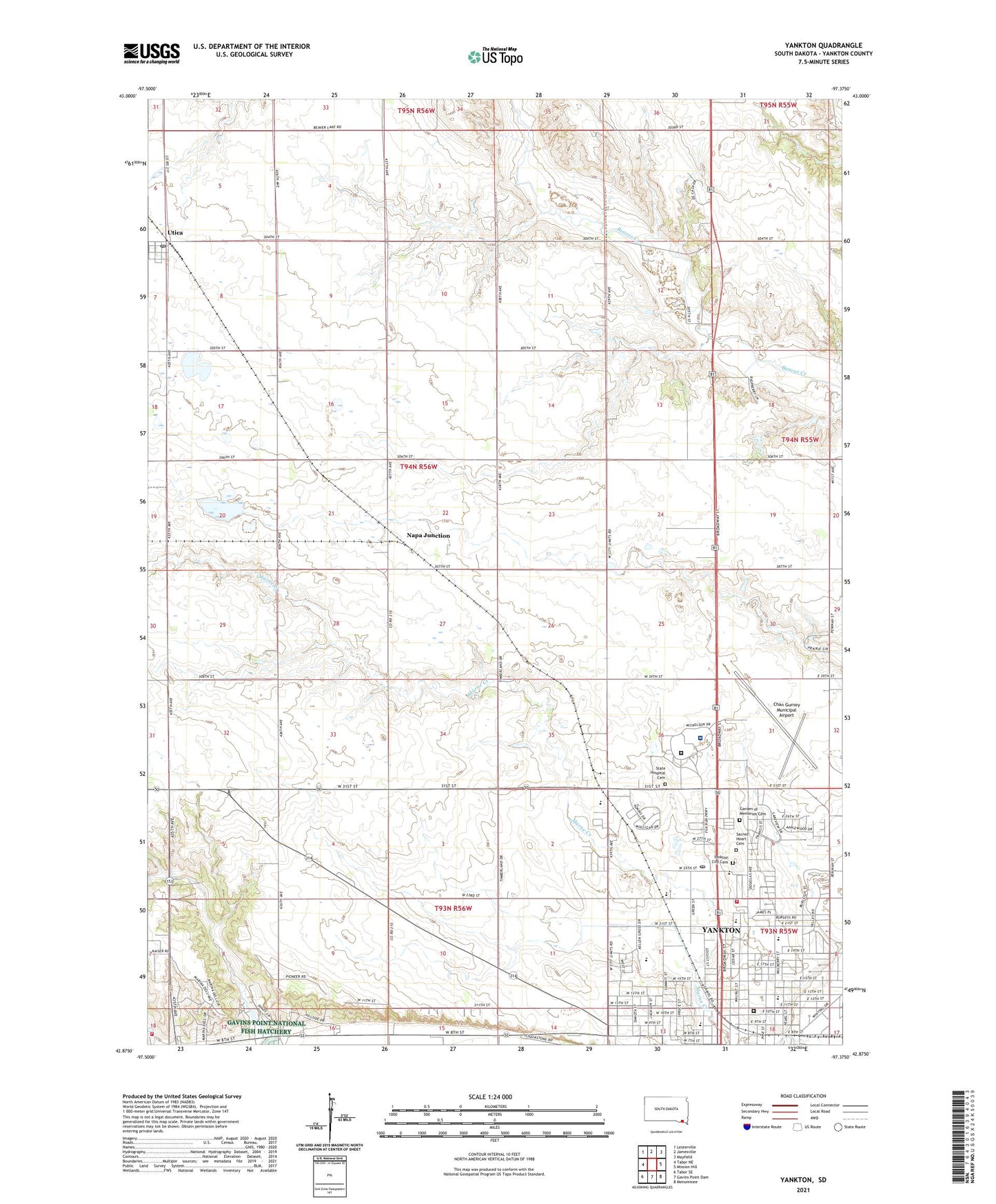
2021 topographic map quadrangle Yankton in the state of South Dakota. Scale: 1:24000. Based on the newly updated USGS 7.5' US Topo map series, this map is in the following counties: Yankton. The map contains contour data, water features, and other items you are used to seeing on USGS maps, but also has updated roads and other features. This is the next generation of topographic maps. Printed on high-quality waterproof paper with UV fade-resistant inks.
Quads adjacent to this one:
West: Tabor NE
Northwest: Lesterville
North: Jamesville
Northeast: Mayfield
East: Mission Hill
Southeast: Menominee
South: Gavins Point Dam
Southwest: Tabor SE
Contains the following named places: Beadle Elementary School, Chan Gurney Municipal Airport, City of Yankton, Crockett Park, Fantle Memorial Park, Garden of Memories Cemetery, Garfield School, KYNT-AM (Yankton), Laddie E Cimpl Arena, Lewis and Clark Specialty Hospital, Lincoln Elementary School, Missouri Valley Christian Academy, Napa Junction, Old Library Gym, Pershing School, Sacred Heart Cemetery, Sacred Heart Elementary School, South Dakota Hospital For The Insane, South Dakota Human Services Center, State Hospital Cemetery, Stewart Elementary School, Town of Utica, Township of Utica, Tripp Park, Utica, Utica Post Office, Yankton City Cemetery, Yankton College, Yankton County Emergency Medical Services, Yankton High School, Yankton Mall, Yankton Middle School, Yankton Plaza, Yankton Post Office, ZIP Code: 57078