MyTopo
Tabor SE Nebraska US Topo Map
Couldn't load pickup availability
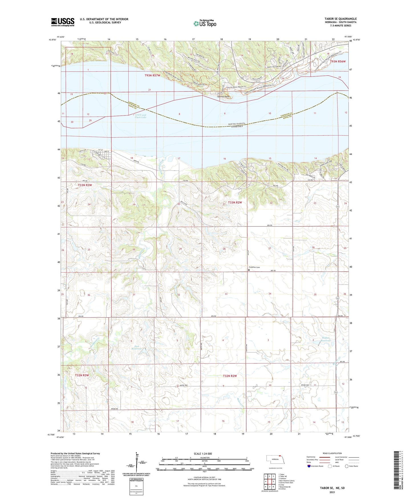
2021 topographic map quadrangle Tabor SE in the states of Nebraska, South Dakota. Scale: 1:24000. Based on the newly updated USGS 7.5' US Topo map series, this map is in the following counties: Knox, Yankton. The map contains contour data, water features, and other items you are used to seeing on USGS maps, but also has updated roads and other features. This is the next generation of topographic maps. Printed on high-quality waterproof paper with UV fade-resistant inks.
Quads adjacent to this one:
West: Bon Homme Colony
Northwest: Tabor
North: Tabor NE
Northeast: Yankton
East: Gavins Point Dam
Southeast: Crofton
South: Bloomfield NE
Southwest: Lindy
Contains the following named places: Antelope Point, Burbach Campground, Crofton United Church, Deep Water Campground, Deep Water Recreation Area, Fairview Heights, Frankfort Cemetery, Frankfort School, Gavins Point, Gavins Point Recreation Area, Hideaway Acres State Recreation Area, KQHU-FM (Yankton), Lesterville Recreation Area, Lewis and Clark Lake State Recreation Area, Midway Recreation Area, Northshore Development, Oak Hills Addition, Sand Island, Sego Island, Sioux Council Boy Scout Reservation, Steffan Dam, Steffan Reservoir, Township of Frankfort, Township of Lake Port, Township of North Frankfort, Weigand Campground, Weigand Creek, Weigand Recreation Area, West Blyville School, White Bear Cliff, Zart Dam, Zart Reservoir, ZIP Code: 68730