MyTopo
Altamont Tennessee US Topo Map
Couldn't load pickup availability
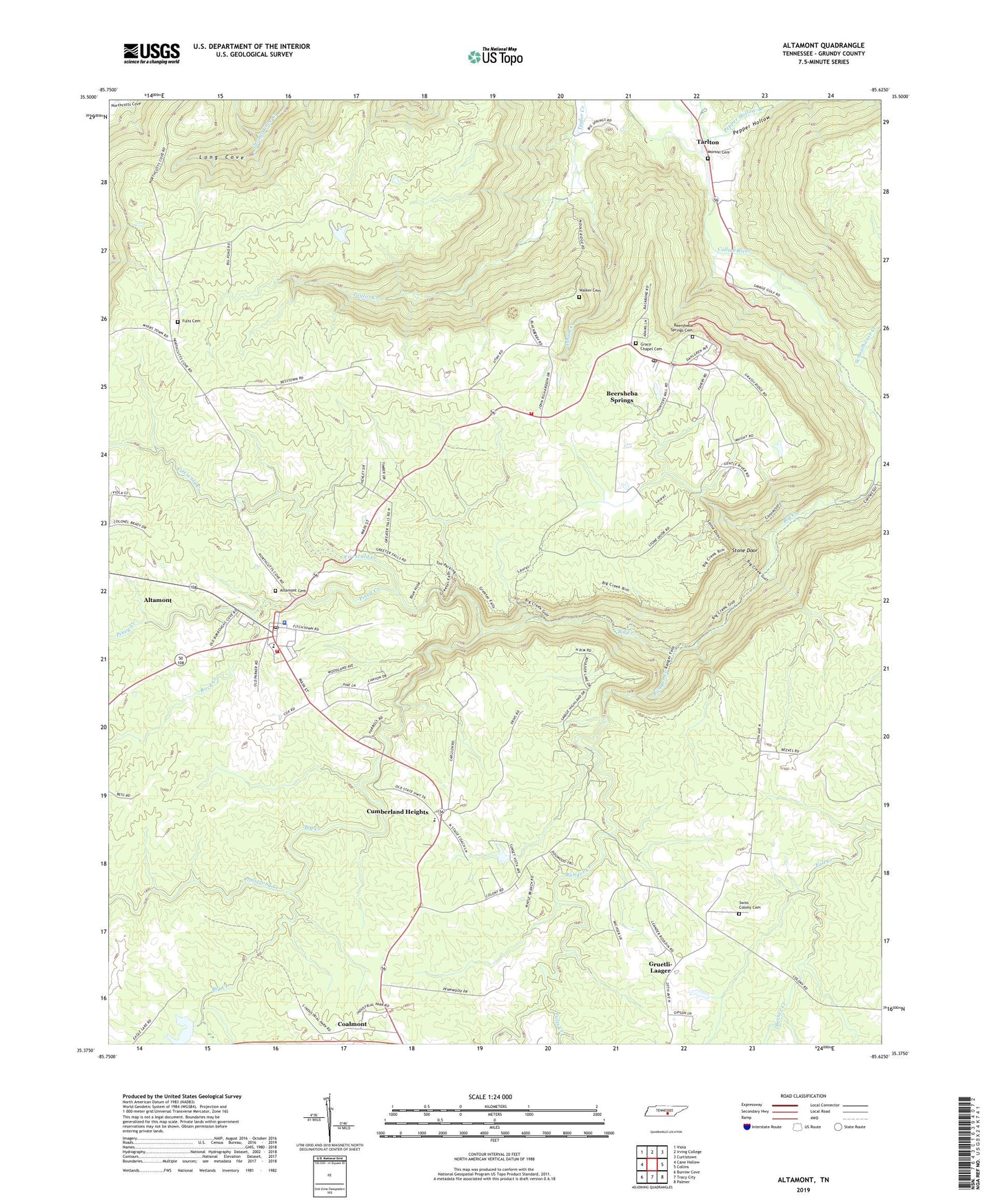
2019 topographic map quadrangle Altamont in the state of Tennessee. Scale: 1:24000. Based on the newly updated USGS 7.5' US Topo map series, this map is in the following counties: Grundy. The map contains contour data, water features, and other items you are used to seeing on USGS maps, but also has updated roads and other features. This is the next generation of topographic maps. Printed on high-quality waterproof paper with UV fade-resistant inks.
Quads adjacent to this one:
West: Cane Hollow
Northwest: Viola
North: Irving College
Northeast: Curtistown
East: Collins
Southeast: Palmer
South: Tracy City
Southwest: Burrow Cove
Contains the following named places: Altamont, Altamont Academy, Altamont Baptist Church, Altamont Cemetery, Altamont Division, Altamont Post Office, Altamont Volunteer Fire Department, Armstrong Creek, Beersheba Springs, Beersheba Springs Cemetery, Beersheba Springs Post Office, Beersheba Springs Volunteer Fire Department, Berner Creek, Big Creek, Browns Church, Carol Dam, Carol Lake, Commissioner District 1, Cumberland Heights, Cumberland Heights Clinic, Firescald Creek, Fults Cemetery, Fults Creek, Grace Chapel, Grace Chapel Cemetery, Gruetli Church, Gruetli Gas Field, Grundy County, Grundy County Courthouse, Grundy County Sheriff's Office, Isham Creek, Killians Chapel, Morton Memorial Cemetery, Morton Memorial United Methodist Church, North Elementary School, Panhandle School, Parker Dam, Parker Lake, Pepper Hollow, Piney Creek, Purdons, Ranger Creek, Rock Creek, Rocky Creek, Rusty Cup Creek, Schoolhouse Creek, Stone Door, Swiss Colony Cemetery, Tarlton, Tarlton School, The Church of Jesus Christ of Latter Day Saints, Town of Altamont, Town of Beersheba Springs, Utah School, Walker Cemetery, Whispering Pines School, ZIP Codes: 37305, 37339