MyTopo
Curtistown Tennessee US Topo Map
Couldn't load pickup availability
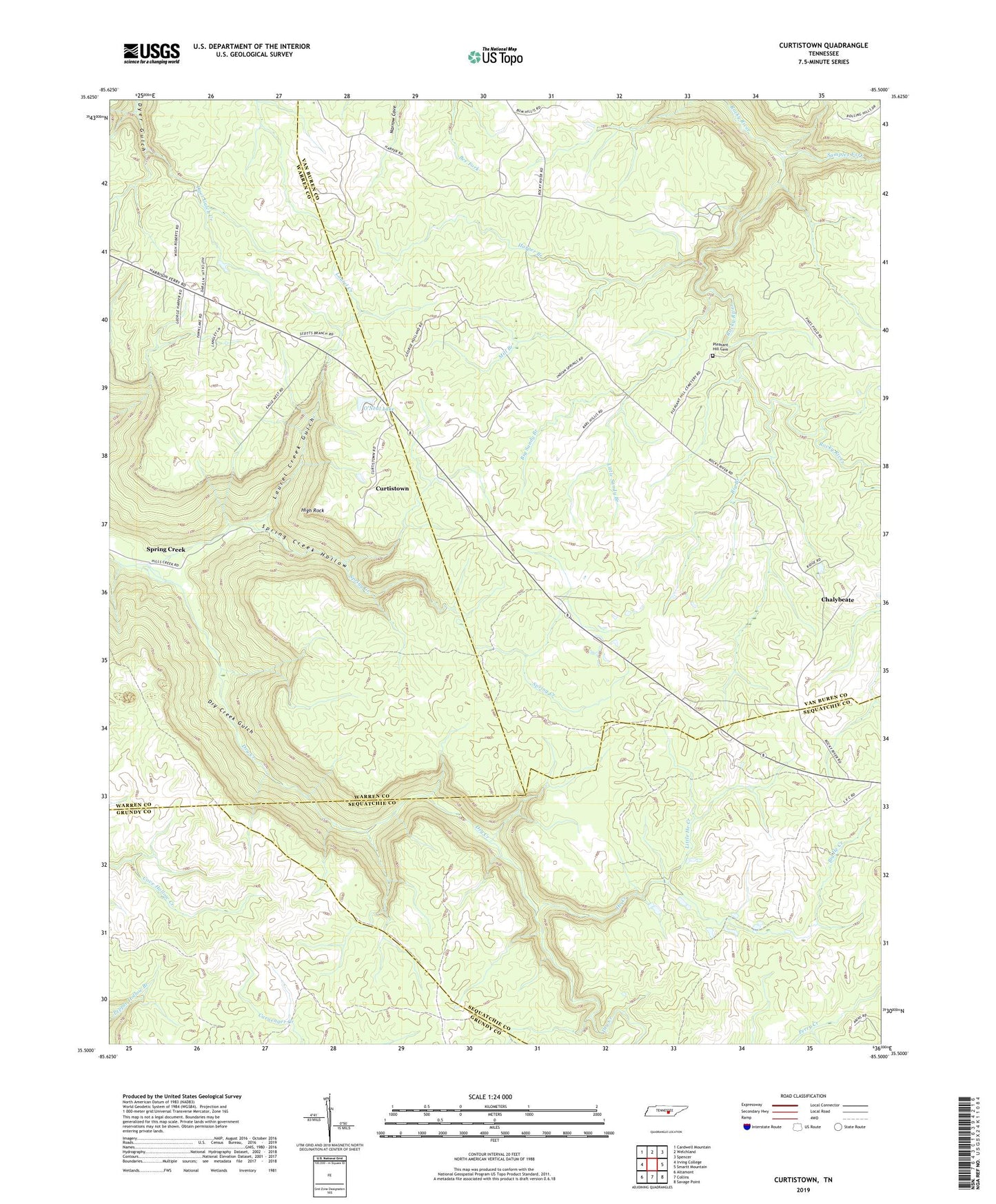
2022 topographic map quadrangle Curtistown in the state of Tennessee. Scale: 1:24000. Based on the newly updated USGS 7.5' US Topo map series, this map is in the following counties: Warren, Van Buren, Sequatchie, Grundy. The map contains contour data, water features, and other items you are used to seeing on USGS maps, but also has updated roads and other features. This is the next generation of topographic maps. Printed on high-quality waterproof paper with UV fade-resistant inks.
Quads adjacent to this one:
West: Irving College
Northwest: Cardwell Mountain
North: Welchland
Northeast: Spencer
East: Smartt Mountain
Southeast: Savage Point
South: Collins
Southwest: Altamont
This map covers the same area as the classic USGS quad with code o35085e5.
Contains the following named places: Big Branch, Big He Creek, Big Sandy Branch, Chalybeate, Cumberland Plateau Observatory, Curtistown, Dry Creek Gulch, Harper Branch, He Creek, High Rock, Laurel Creek, Laurel Creek Gulch, Little He Creek, Little Sandy Branch, Mill Branch, O'Neal Lake, O'Neal Lake Dam, Pleasant Hill Cemetery, Pleasant Hill School, Powers Mine, Samples Fork, Spring Creek, Spring Creek Hollow