MyTopo
Bethpage Tennessee US Topo Map
Couldn't load pickup availability
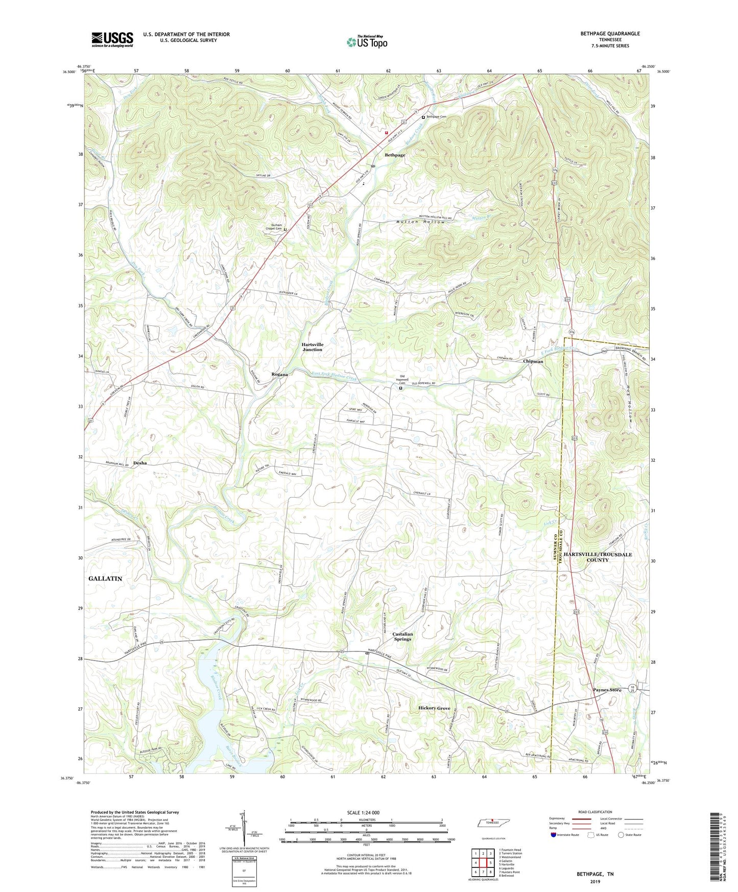
2019 topographic map quadrangle Bethpage in the state of Tennessee. Scale: 1:24000. Based on the newly updated USGS 7.5' US Topo map series, this map is in the following counties: Sumner, Trousdale. The map contains contour data, water features, and other items you are used to seeing on USGS maps, but also has updated roads and other features. This is the next generation of topographic maps. Printed on high-quality waterproof paper with UV fade-resistant inks.
Quads adjacent to this one:
West: Gallatin
Northwest: Fountain Head
North: Turners Station
Northeast: Westmoreland
East: Hartsville
Southeast: Bellwood
South: Hunters Point
Southwest: Laguardo
Contains the following named places: Bates Branch, Bethpage, Bethpage Census Designated Place, Bethpage Division, Bethpage Elementary School, Bethpage Post Office, Bethpage Station, Bethpage United Methodist Church, Bethpape Cemetery, Bledsoe Creek Camping State Park, Bledsoe School, Brush Fork, Brushy Fork Creek, Campbell Hollow, Castalian Springs, Castalian Springs Census Designated Place, Castalian Springs Division, Castalian Springs Post Office, Castalian Springs United Methodist Church, Chipman, Commissioner District 3, Desha, Deshea Creek, Dry Fork, Durham Chapel, Durham Chapel Cemetery, Durham's Chapel School, East Fork Bledsoe Creek, Enon Church, Harris Mill, Hartsville Junction, Hickory Grove, Hickory Grove School, Hog Hollow, Hopewell Church, Kansas School, Lick Creek, Mutton Branch, Mutton Hollow, Oakland, Old Bethpage, Old Hopewell Cemetery, Old Hopewell Church, Old Union Church, Paynes Store, Philippi Church, Pryor Branch, Red Chief Orchard, Rogana, Rogues Fork Creek, Shady Cove Resort, Shiloh Presbyterian Church, Sideview, Southeast Community Fire Department, Sumner County Quarry