MyTopo
Bellwood Tennessee US Topo Map
Couldn't load pickup availability
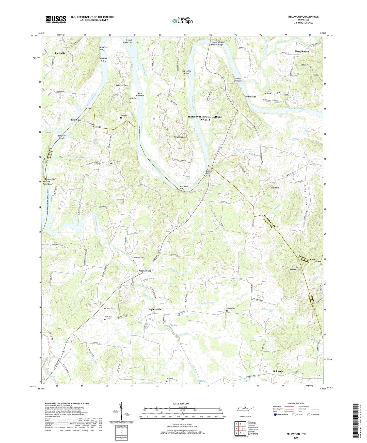
2022 topographic map quadrangle Bellwood in the state of Tennessee. Scale: 1:24000. Based on the newly updated USGS 7.5' US Topo map series, this map is in the following counties: Wilson, Trousdale, Smith. The map contains contour data, water features, and other items you are used to seeing on USGS maps, but also has updated roads and other features. This is the next generation of topographic maps. Printed on high-quality waterproof paper with UV fade-resistant inks.
Quads adjacent to this one:
West: Hunters Point
Northwest: Bethpage
North: Hartsville
Northeast: Hillsdale
East: Dixon Springs
Southeast: New Middleton
South: Shop Springs
Southwest: Lebanon
This map covers the same area as the classic USGS quad with code o36086c2.
Contains the following named places: Athens Missionary Church, Bass Cemetery, Beasleys Bend, Belchers Bluff, Bellview Church, Bellview School, Bellwood, Bellwood School, Berdine Bar, Bethel Church, Carman Cemetery, Cedar Creek, Cedar Creek Church, Cedar Creek Island, Centerville, Clendenon Branch, Clifford Branch, Coleman-Winston Memorial Bridge, Commissioner District 1, Commissioner District 10, Commissioner District 6, Conway School, Dickerson Chapel, Dickson Bluff, Dickson Chapel Recreation Area, Dixon, Douglas Branch, Everetts Branch, Foley Branch, Goose Creek, Goose Creek Bar, Goose Creek Island, Goshen Cemetery, Goshen Church, Gray Hollow, Griffins Landing, Harts Ferry, Hartsville Access Area, Hartsville Island, Hartsville Landing, Hopewell Church, Jackson Branch, Jackson Cemetery, Johnson Branch, King School, Link Branch, Little Goose Creek, Lyles Creek, Mills Island, Mills Island Bar, Mitchells Bluff, Nancy Branch, Neely Branch, Old Lock and Dam Number Five, Old Lock and Dam Number Six, Providence, Providence Presbyterian Church, Providence School, Purnell Branch, Puryears Bend, Reeds Mill, Riadon Branch, Sampson Shoals, Second Creek Island, Shady Grove, Shady Grove Access Area, Spanish Needle Knob, Speck Cemetery, Stone Branch, Taylorsville, Tomlinson Cemetery, Trousdale County Park, Walnut Ridge Church, Ward Branch, Ward Hill, Weir, Weir Cemetery, White Cemetery, Whites Bluff, Whitleys Bluff, Whitleys Island, Young Branch, Zion Church