MyTopo
Collinwood Tennessee US Topo Map
Couldn't load pickup availability
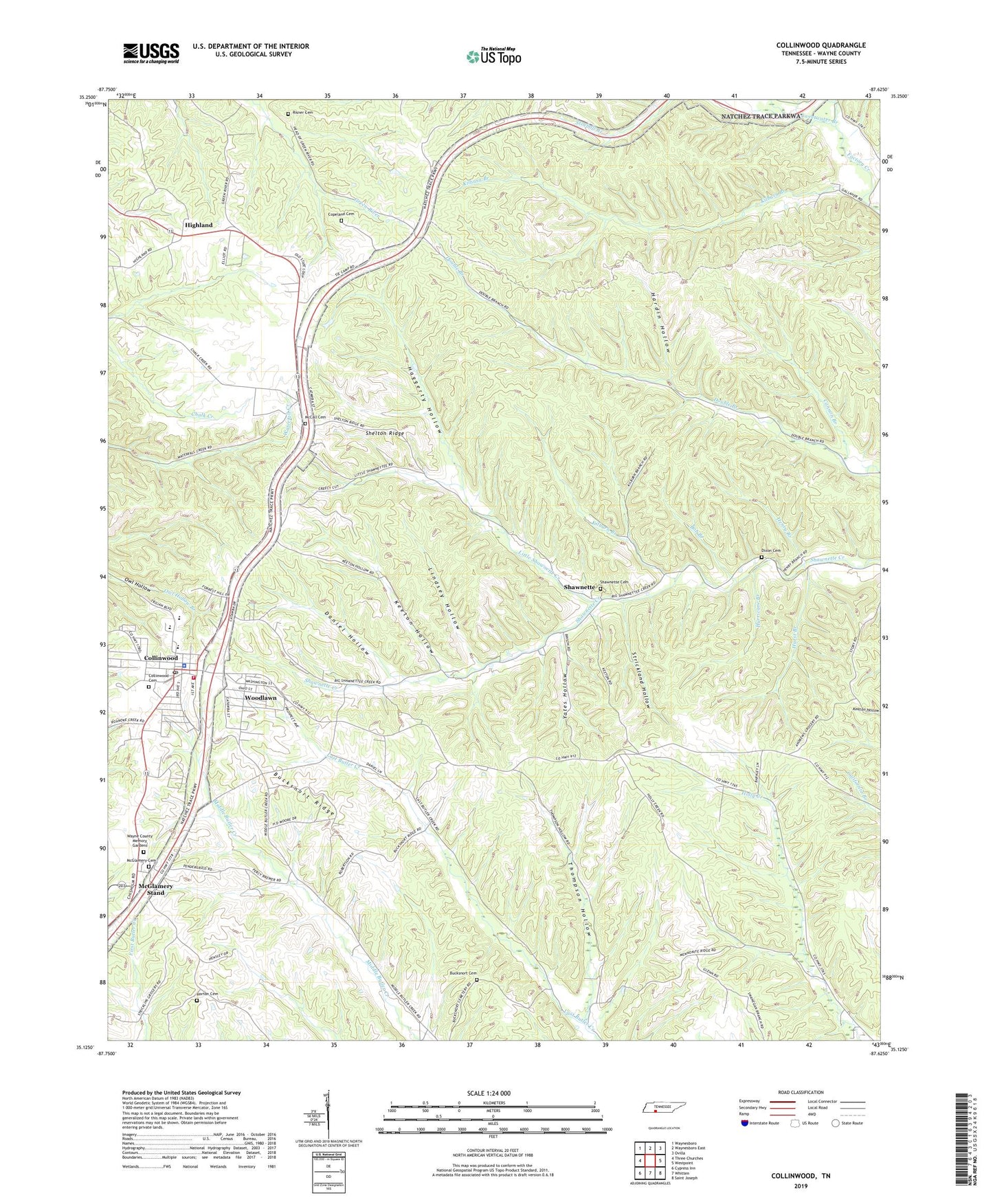
2022 topographic map quadrangle Collinwood in the state of Tennessee. Scale: 1:24000. Based on the newly updated USGS 7.5' US Topo map series, this map is in the following counties: Wayne. The map contains contour data, water features, and other items you are used to seeing on USGS maps, but also has updated roads and other features. This is the next generation of topographic maps. Printed on high-quality waterproof paper with UV fade-resistant inks.
Quads adjacent to this one:
West: Three Churches
Northwest: Waynesboro
North: Waynesboro East
Northeast: Ovilla
East: Westpoint
Southeast: Saint Joseph
South: Whitten
Southwest: Cypress Inn
This map covers the same area as the classic USGS quad with code o35087b6.
Contains the following named places: Bob Branch, Bucksnort Cemetery, Bucksnort Ridge, Cannon Branch, City of Collinwood, Collingwood High School, Collinwood, Collinwood Cemetery, Collinwood Church of Christ, Collinwood City Hall, Collinwood Division, Collinwood Elementary School, Collinwood Freewill Baptist Church, Collinwood Industrial Park, Collinwood Middle School, Collinwood Police Department, Collinwood Post Office, Collinwood United Methodist Church, Collinwood Volunteer Fire Department, Commissioner District 4, Copeland Cemetery, Cyclone, Daniel Hollow, Daniel School, Dixon Cemetery, Factory, Factory School, First Baptist Church, Forestry Fire Tower Collinwood, Glenrock Branch, Haggerty Hollow, Hardin Hollow, Henry Branch, Highland, Highland School, Hollis Prospect, Horton Cemetery, Hurricane Branch, Hurst Branch, Keeton Hollow, Kilburn Branch, Lindsey Hollow, Little Shawnette Creek, Mc Call Cemetery, McCall School, McGlamery Cemetery, McGlamery Stand, Millrock School, Moon, Risner Cemetery, Scab Branch, Shanatee School, Shawnette, Shawnette Cemetery, Shawnette Methodist Church, Shelton Ridge, Starkey, Strickland Hollow, Thompson Hollow, Waterfall Park, Wayne County Memory Gardens, Woodlawn, Yates, Yates Hollow