MyTopo
Dancyville Tennessee US Topo Map
Couldn't load pickup availability
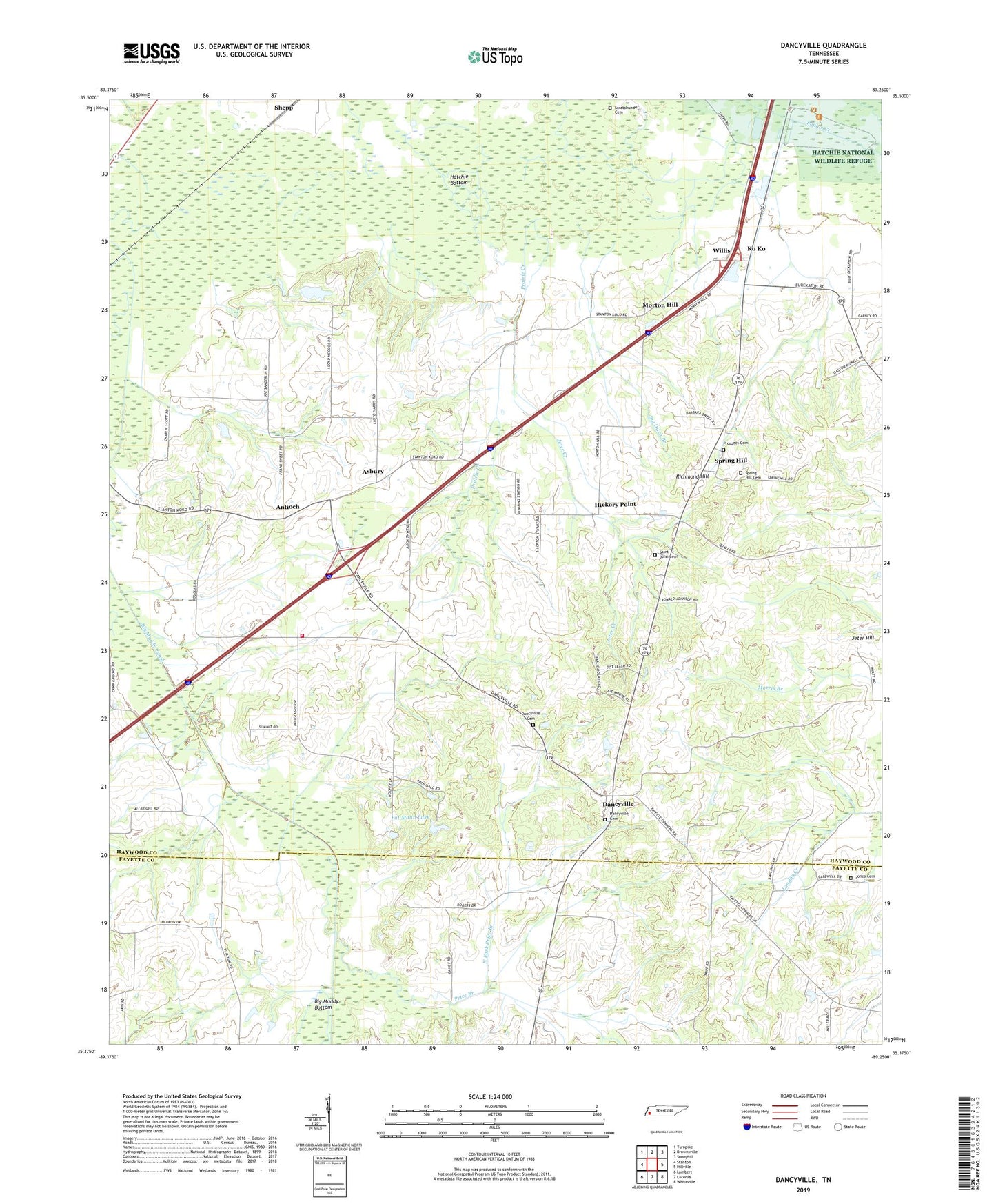
2019 topographic map quadrangle Dancyville in the state of Tennessee. Scale: 1:24000. Based on the newly updated USGS 7.5' US Topo map series, this map is in the following counties: Haywood, Fayette. The map contains contour data, water features, and other items you are used to seeing on USGS maps, but also has updated roads and other features. This is the next generation of topographic maps. Printed on high-quality waterproof paper with UV fade-resistant inks.
Quads adjacent to this one:
West: Stanton
Northwest: Turnpike
North: Brownsville
Northeast: Sunnyhill
East: Hillville
Southeast: Whiteville
South: Laconia
Southwest: Lambert
Contains the following named places: Antioch, Asbury, Big Ditch Branch, Big Muddy Bottom, Big Muddy Canal, Brownsville - Haywood County Fire Department District 10, Commissioner District 8, Dancyville, Dancyville Cemetery, Dancyville Census Designated Place, Dancyville School, Dancyville United Methodist Church, Douglass Chapel, Douglass School, Hickory Point, Jeter Creek, Jeter Hill, Jones Cemetery, Ko Ko, McKenzie Chapel, Morton Hill, North Fork Price Branch, Pat Mann Dam, Pat Mann Lake, Poplar Creek, Prairie Creek, Price Branch, Prospect, Prospect Cemetery, Prospect Church, Reeves School, Richmond Hill, Saint John, Saint John Church, Saint John Missionary Baptist Cemetery, Saint Johns School, Scratchunder Cemetery, Spring Hill, Spring Hill Church, Spring Hill United Methodist Cemetery, Stanton Division, Wilkinson Corner, Willett School, Willis, Willis School, Zu Zu, ZIP Code: 38069