MyTopo
Turnpike Tennessee US Topo Map
Couldn't load pickup availability
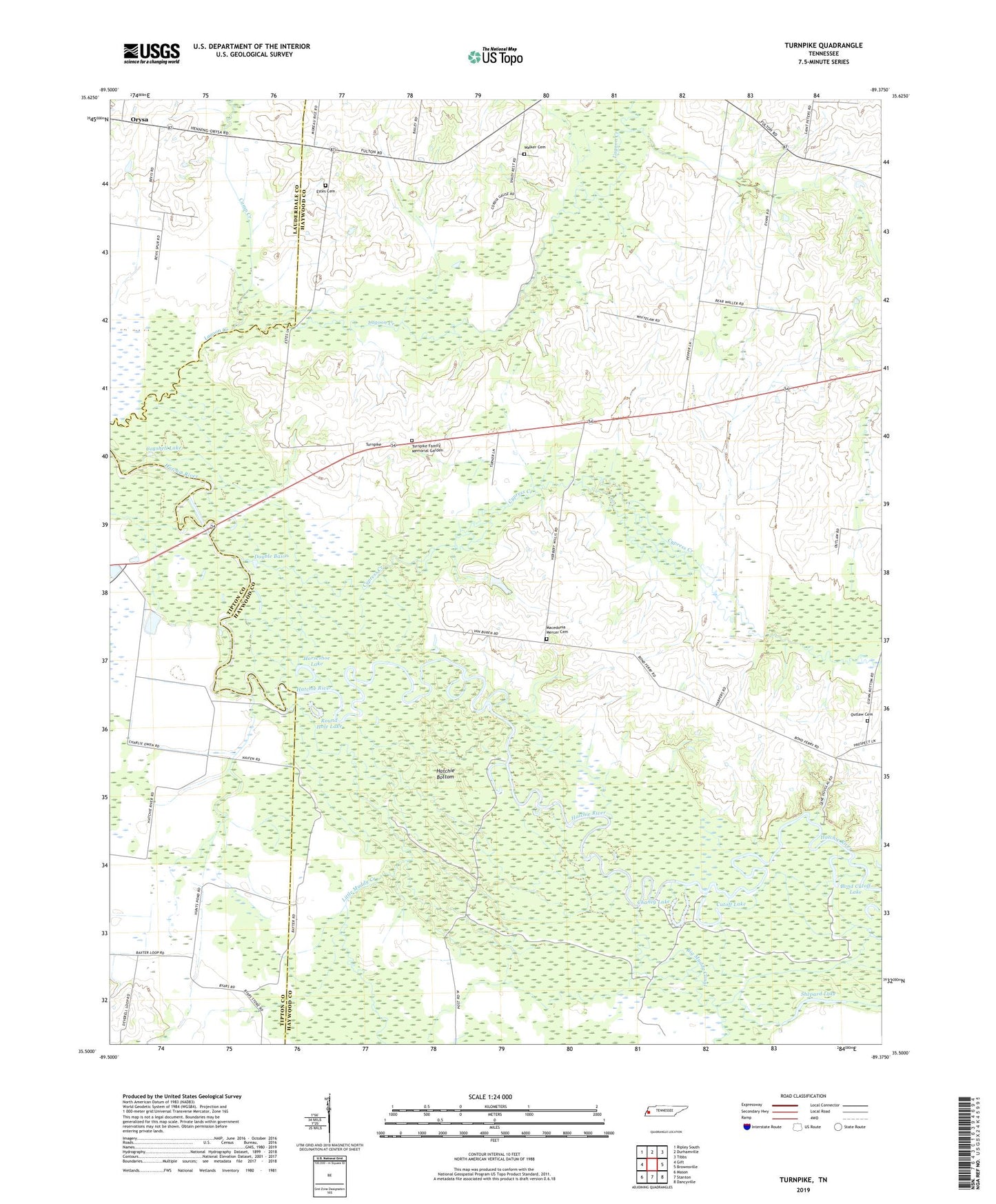
2022 topographic map quadrangle Turnpike in the state of Tennessee. Scale: 1:24000. Based on the newly updated USGS 7.5' US Topo map series, this map is in the following counties: Haywood, Tipton, Lauderdale. The map contains contour data, water features, and other items you are used to seeing on USGS maps, but also has updated roads and other features. This is the next generation of topographic maps. Printed on high-quality waterproof paper with UV fade-resistant inks.
Quads adjacent to this one:
West: Gift
Northwest: Ripley South
North: Durhamville
Northeast: Tibbs
East: Brownsville
Southeast: Dancyville
South: Stanton
Southwest: Mason
This map covers the same area as the classic USGS quad with code o35089e4.
Contains the following named places: Anthony School, Big Muddy Creek, Bond Cutoff Lake, Camp Creek, Cannon Lake, Cannon Lake Dam, Chaney Lake, Cogshell Lake, Commissioner District 9, Cutoff Lake, Cypress Creek, Double Basin, Estes Cemetery, Horseshoe Lake, Lebanon Division, Little Muddy Creek, Macedonia Mercer Cemetery, Mercer School, New Hope School, Orysa, Outlaw Cemetery, Round Hole Lake, Saint Peter School, Saint Peters, Saint Peters Church, Shepard Lake, Turnpike, Turnpike Family Memorial Garden, Walker Cemetery, Walker School