MyTopo
Daus Tennessee US Topo Map
Couldn't load pickup availability
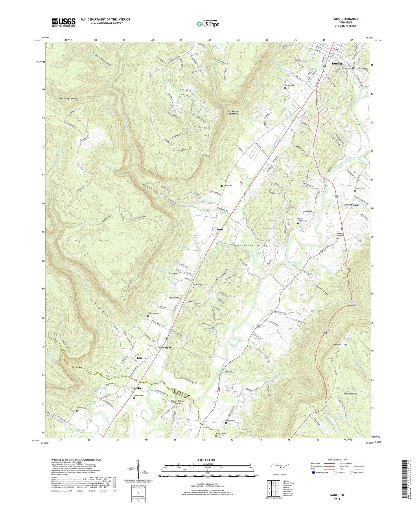
2019 topographic map quadrangle Daus in the state of Tennessee. Scale: 1:24000. Based on the newly updated USGS 7.5' US Topo map series, this map is in the following counties: Sequatchie, Marion, Grundy. The map contains contour data, water features, and other items you are used to seeing on USGS maps, but also has updated roads and other features. This is the next generation of topographic maps. Printed on high-quality waterproof paper with UV fade-resistant inks.
Quads adjacent to this one:
West: Palmer
Northwest: Collins
North: Savage Point
Northeast: Mount Airy
East: Henson Gap
Southeast: Fairmount
South: Ketner Gap
Southwest: Whitwell
Contains the following named places: Anderson Gap, Anderson Mill Creek, Andersons Mill, Barker Branch, Barker Cove, Boynton Spring, Bryant, Bryant Branch, Bryant Cemetery, Cartwright, Cartwright First Baptist Church, Cedar Spring, Cedar Spring Church, Cedar Spring School, Cedar Springs, Center Point, Center Point School, Chapel Hill Cemetery, Chapel Hill Church, City of Dunlap, Commissioner District 5, Commissioner District 6, Commissioner District 7, Condra, Condra Cemetery, Cookston Cave Creek, Cookston Cemetery, Coops Creek, Cordell Cemetery, Cordell Lane Branch, Daniel Spring, Daus, Daus School, Dunlap, Dunlap City Hall, Dunlap Fire Department, Dunlap Police Department, Dunlap Post Office, Easterly Branch, Ernest Taylor Dam, Ernest Taylor Lake, First Baptist Church, Glen Barker Dam, Glen Barker Lake, Grayson Mill Creek, Griffith Cemetery, Griffith Elementary School, Hatfield Cemetery, Hendrix Creek, Hicks Creek, Hudson Cemetery, John Henry Chapel School, Johnson Mill Creek, Kell Branch, Kelley Creek, Lane Cove, Liberty, Liberty School, Merriman Branch, Mosley Gulf, New Hope, New Hope Church, Olds Mill, Pickett Cemetery, Poplar Spring Hollow, Possum Bottom Airport, Rankin Cemetery, Reel Cove, Robinson Branch, Rogers Cemetery, Sequatchie County, Sequatchie County Courthouse, Sequatchie Quarry, Sourwood Creek, Southend Volunteer Fire Department, Stillhouse Branch, Stone Cave Spring, Stone Cemetery, Stone Coalbank Creek, Stone Creek, Thans Chapel Cemetery, Thurman Creek, Woodcock Creek, Woodcock Gulf, WSVC-AM (Dunlap)